Bharūch night lights from space
Night Light of Bharūch (Gujarat) from space (India) Src. Average luminocity for 10x10km area is 64.822% and for 50x50km: 26.3948%.
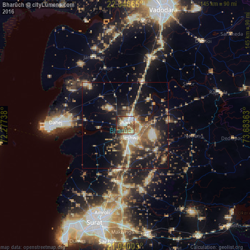

Analysis of Bharūch night lights 2016
Square area 10x10 km:
 6.25%
6.25%90-99
23.67%80-89
8.71%70-79
4.36%60-69
12.69%50-59
12.88%40-49
10.61%30-39
9.66%20-29
8.52%10-19
2.65%0-9
0%Square area 50x50 km:
1.6%90-99
4.67%80-89
3.43%70-79
2.57%60-69
4.28%50-59
5.95%40-49
5.19%30-39
5.1%20-29
7.67%10-19
17.89%0-9
41.65%Clear (daylight) street map image can be seen on geolist.org.
Map coordinates:
22° 20' 47.9" North, 72° 16' 38.6" East
21° 41' 41.4" North, 72° 58' 49.8" East
21° 2' 24.1" North, 73° 41' 1.1" East
Some cities around Bharūch sort by population:
• Ankleshwar
7 km =4.3 mi,  171°
171°
• Jambusar
43.9 km =27.3 mi,  334°
334°
• Kosamba
26 km =16.2 mi,  185°
185°
• Amod
35.1 km =21.8 mi,  341°
341°
• Kāthor
45.4 km =28.2 mi, 185°
• Olpād
46.3 km =28.8 mi,  210°
210°
• Hansot
21.6 km =13.4 mi,  235°
235°
• Sinor
44.2 km =27.5 mi,  57°
57°
1276100 (p: 153,528)
Sources (retrieved 2019-11-25):
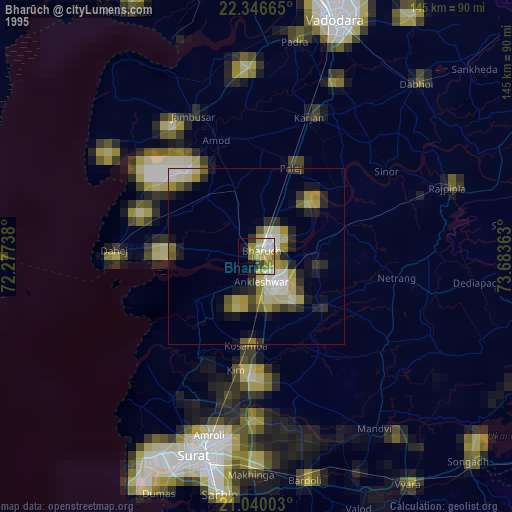
» NASA, Earths city lights 1995
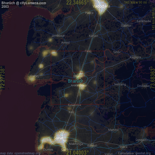
» NASA city lights 2003
» Earth at Night: Flat Maps 2012, 2016