Ankleshwar night lights from space
Night Light of Ankleshwar (Gujarat) from space (India) Src. Average luminocity for 10x10km area is 71.6288% and for 50x50km: 28.8008%.
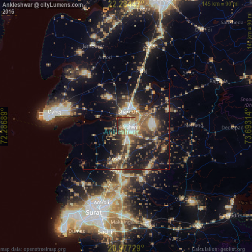
Analysis of Ankleshwar night lights 2016
Square area 10x10 km:
 12.88%
90-99
25.38%80-89
12.69%70-79
5.11%60-69
11.55%50-59
9.09%40-49
6.44%30-39
7.39%20-29
9.47%10-19
0%0-9
0%Square area 50x50 km:
1.63%90-99
4.92%80-89
3.79%70-79
2.89%60-69
4.54%50-59
6.33%40-49
6.14%30-39
5.93%20-29
9.08%10-19
19.85%0-9
34.91%Clear (daylight) street map image can be seen on geolist.org.
Map coordinates:
22° 17' 4.1" North, 72° 17' 12.8" East
21° 37' 56.5" North, 72° 59' 24" East
20° 58' 38.2" North, 73° 41' 35.3" East
Some cities around Ankleshwar sort by population:
• Bharūch
7 km =4.3 mi,  351°
351°
• Kosamba
19.2 km =11.9 mi,  189°
189°
• Amod
42 km =26.1 mi,  342°
342°
• Amroli
45.2 km =28.1 mi,  200°
200°
• Kāthor
38.6 km =24 mi, 187°
• Utrān
46.2 km =28.7 mi, 196°
• Olpād
41.1 km =25.5 mi,  216°
216°
• Hansot
19.6 km =12.2 mi,  254°
254°
1278553 (p: 74,742)
Sources (retrieved 2019-11-25):
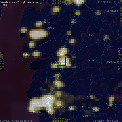
» NASA, Earths city lights 1995
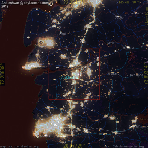
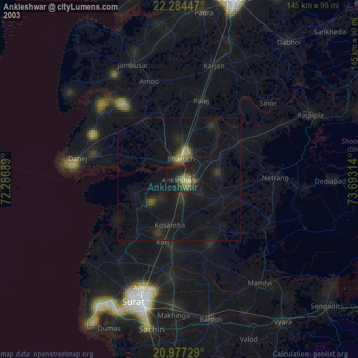
» NASA city lights 2003
» Earth at Night: Flat Maps 2012, 2016