Singrauli night lights from space
Night Light of Singrauli (Madhya Pradesh) from space (India) Src. Average luminocity for 10x10km area is 68.4015% and for 50x50km: 27.579%.
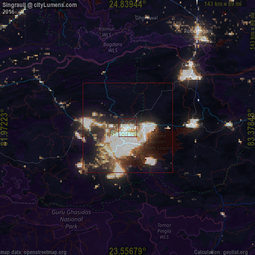
Analysis of Singrauli night lights 2016
Square area 10x10 km:
 23.3%
23.3%90-99
20.45%80-89
7.01%70-79
8.33%60-69
3.98%50-59
3.79%40-49
4.73%30-39
3.6%20-29
14.58%10-19
10.23%0-9
0%Square area 50x50 km:
7.74%90-99
5.79%80-89
2.37%70-79
2.03%60-69
2.46%50-59
3.81%40-49
3.44%30-39
4.55%20-29
7.29%10-19
11.12%0-9
49.4%Clear (daylight) street map image can be seen on geolist.org.
Map coordinates:
24° 50' 22" North, 81° 58' 20" East
24° 11' 59" North, 82° 40' 31.3" East
23° 33' 24.4" North, 83° 22' 42.5" East
Some cities around Singrauli sort by population:
• Renukūt
36.6 km =22.7 mi,  87°
87°
• Obra
39.9 km =24.8 mi,  52°
52°
• Sidhi
83.8 km =52.1 mi,  285°
285°
• Robertsganj
67.3 km =41.8 mi,  36°
36°
• Kota
53.7 km =33.4 mi,  59°
59°
• Chopan
50 km =31.1 mi, 44°
• Dūdhi
57.4 km =35.7 mi, 88°
• Ghorāwal
62.6 km =38.9 mi,  9°
9°
7279754 (p: 185,580)
Sources (retrieved 2019-11-25):
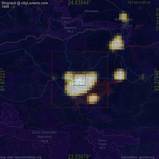
» NASA, Earths city lights 1995
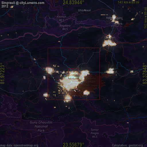
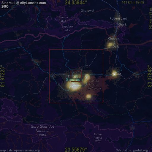
» NASA city lights 2003
» Earth at Night: Flat Maps 2012, 2016