Robertsganj night lights from space
Night Light of Robertsganj (Uttar Pradesh) from space (India) Src. Average luminocity for 10x10km area is 49.0774% and for 50x50km: 7.7724%.
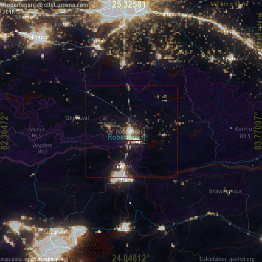

Analysis of Robertsganj night lights 2016
Square area 10x10 km:
 6.75%
6.75%90-99
7.54%80-89
5.56%70-79
6.15%60-69
7.74%50-59
8.33%40-49
13.1%30-39
14.88%20-29
10.32%10-19
18.45%0-9
1.19%Square area 50x50 km:
0.93%90-99
1.01%80-89
0.45%70-79
0.51%60-69
0.86%50-59
1.21%40-49
1.61%30-39
2.07%20-29
3.12%10-19
6.63%0-9
81.6%Clear (daylight) street map image can be seen on geolist.org.
Map coordinates:
25° 19' 32.9" North, 82° 21' 53" East
24° 41' 19" North, 83° 4' 4.2" East
24° 2' 53.2" North, 83° 46' 15.5" East
Some cities around Robertsganj sort by population:
• Renukūt
52.6 km =32.7 mi,  183°
183°
• Obra
31.1 km =19.3 mi,  195°
195°
• Chunār
52.3 km =32.5 mi,  339°
339°
• Ahraura
36.6 km =22.7 mi,  354°
354°
• Chakia
43 km =26.7 mi,  21°
21°
• Kota
27.7 km =17.2 mi,  166°
166°
• Chopan
19.3 km =12 mi,  193°
193°
• Ghorāwal
30 km =18.6 mi,  284°
284°
1258111 (p: 37,855)
Sources (retrieved 2019-11-25):
» Earth at Night: Flat Maps 2012, 2016