Kota night lights from space
Night Light of Kota (Uttar Pradesh) from space (India) Src. Average luminocity for 10x10km area is 2.4841% and for 50x50km: 6.9715%.
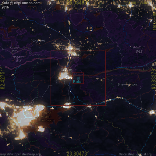
Analysis of Kota night lights 2016
Square area 10x10 km:
 0%
0%90-99
0%80-89
0%70-79
0.4%60-69
0%50-59
0%40-49
0.2%30-39
0.2%20-29
0%10-19
6.35%0-9
92.86%Square area 50x50 km:
1.37%90-99
1.28%80-89
0.43%70-79
0.34%60-69
0.62%50-59
0.89%40-49
0.86%30-39
0.88%20-29
2.41%10-19
6.36%0-9
84.57%Clear (daylight) street map image can be seen on geolist.org.
Map coordinates:
25° 5' 5.6" North, 82° 25' 39" East
24° 26' 47.1" North, 83° 7' 50.3" East
23° 48' 17" North, 83° 50' 1.5" East
Some cities around Kota sort by population:
• Singrauli
53.7 km =33.4 mi,  239°
239°
• Renukūt
27.3 km =17 mi,  200°
200°
• Obra
14.8 km =9.2 mi,  257°
257°
• Robertsganj
27.7 km =17.2 mi,  346°
346°
• Ahraura
64.1 km =39.8 mi, 351°
• Chopan
13.6 km =8.5 mi,  306°
306°
• Dūdhi
28.2 km =17.5 mi,  156°
156°
• Ghorāwal
49.3 km =30.6 mi, 313°
1266050 (p: 14,632)
Sources (retrieved 2019-11-25):
» Earth at Night: Flat Maps 2012, 2016