Sidhpura night lights from space
Night Light of Sidhpura (Uttar Pradesh) from space (India) Src. Average luminocity for 10x10km area is 7.1111% and for 50x50km: 7.5235%.
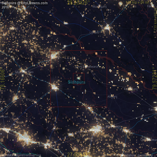
Analysis of Sidhpura night lights 2016
Square area 10x10 km:
 0%
0%90-99
0.79%80-89
0.79%70-79
0%60-69
1.98%50-59
0.6%40-49
3.57%30-39
2.18%20-29
0.6%10-19
1.19%0-9
88.29%Square area 50x50 km:
0.29%90-99
0.88%80-89
0.83%70-79
0.69%60-69
0.7%50-59
1.12%40-49
1.86%30-39
2.61%20-29
2.67%10-19
4.41%0-9
83.94%Clear (daylight) street map image can be seen on geolist.org.
Map coordinates:
28° 15' 15.3" North, 78° 9' 57.8" East
27° 37' 59.2" North, 78° 52' 9" East
27° 0' 30.3" North, 79° 34' 20.3" East
Some cities around Sidhpura sort by population:
• Kāsganj
29.4 km =18.3 mi,  311°
311°
• Ganj Dundwāra
13.2 km =8.2 mi,  32°
32°
• Soron
31.1 km =19.3 mi,  337°
337°
• Sahāwar
18.4 km =11.4 mi,  349°
349°
• Mārahra
31.7 km =19.7 mi,  291°
291°
• Patiāli
14.2 km =8.8 mi,  63°
63°
• Amānpur
15.6 km =9.7 mi,  304°
304°
• Sakīt
23.8 km =14.8 mi,  201°
201°
1256367 (p: 14,815)
Sources (retrieved 2019-11-25):
» Earth at Night: Flat Maps 2012, 2016