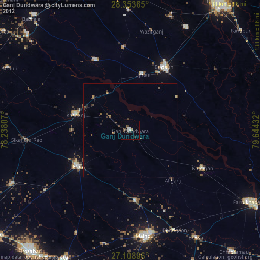
Ganj Dundwāra night lights from space
Night Light of Ganj Dundwāra (Uttar Pradesh) from space (India) Src. Average luminocity for 10x10km area is 12.9385% and for 50x50km: 4.7068%.
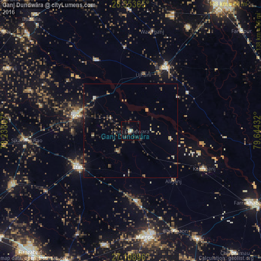
Analysis of Ganj Dundwāra night lights 2016
Square area 10x10 km:
 0.6%
0.6%90-99
1.79%80-89
1.59%70-79
0%60-69
0.2%50-59
2.78%40-49
2.58%30-39
1.59%20-29
8.53%10-19
4.17%0-9
76.19%Square area 50x50 km:
0.08%90-99
0.4%80-89
0.37%70-79
0.71%60-69
0.35%50-59
0.69%40-49
1.32%30-39
1.24%20-29
1.54%10-19
2.23%0-9
91.07%Clear (daylight) street map image can be seen on geolist.org.
Map coordinates:
28° 21' 13.1" North, 78° 14' 17.1" East
27° 43' 59.1" North, 78° 56' 28.3" East
27° 6' 32.3" North, 79° 38' 39.6" East
Some cities around Ganj Dundwāra sort by population:
• Kāsganj
30.3 km =18.8 mi,  286°
286°
• Kakrāla
30.6 km =19 mi,  54°
54°
• Soron
26 km =16.2 mi,  312°
312°
• Sahāwar
12.7 km =7.9 mi,  303°
303°
• Usehat
30 km =18.6 mi,  76°
76°
• Sidhpura
13.2 km =8.2 mi,  212°
212°
• Patiāli
7.3 km =4.5 mi,  129°
129°
• Amānpur
20.1 km =12.5 mi,  263°
263°
1272207 (p: 46,314)
Sources (retrieved 2019-11-25):
» Earth at Night: Flat Maps 2012, 2016