Sehore night lights from space
Night Light of Sehore (Madhya Pradesh) from space (India) Src. Average luminocity for 10x10km area is 45.0265% and for 50x50km: 11.3222%.
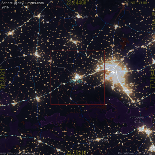
Analysis of Sehore night lights 2016
Square area 10x10 km:
 7.2%
7.2%90-99
10.8%80-89
2.65%70-79
5.49%60-69
4.73%50-59
5.49%40-49
9.09%30-39
8.33%20-29
14.2%10-19
31.44%0-9
0.57%Square area 50x50 km:
0.86%90-99
1.52%80-89
0.67%70-79
1.11%60-69
1.67%50-59
2.18%40-49
2.12%30-39
3.12%20-29
3.74%10-19
8.03%0-9
74.97%Clear (daylight) street map image can be seen on geolist.org.
Map coordinates:
23° 50' 40.9" North, 76° 22' 48.8" East
23° 12' 0" North, 77° 4' 60" East
22° 33' 7.8" North, 77° 47' 11.3" East
Some cities around Sehore sort by population:
• Bhopal
33.2 km =20.6 mi,  79°
79°
• Shujālpur
44.5 km =27.7 mi,  301°
301°
• Ashta
42.1 km =26.2 mi,  241°
241°
• Mandideep
47.8 km =29.7 mi,  105°
105°
• Narsinghgarh
56.4 km =35 mi,  1°
1°
• Ichhāwar
20.3 km =12.6 mi,  199°
199°
• Akodia
53.4 km =33.2 mi,  292°
292°
• Talen
54.8 km =34.1 mi,  318°
318°
1256913 (p: 99,284)
Sources (retrieved 2019-11-25):
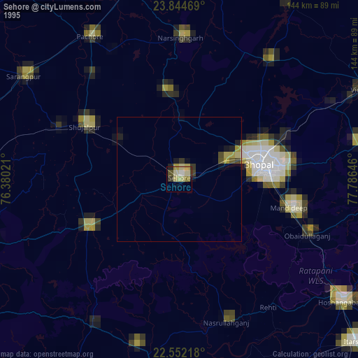
» NASA, Earths city lights 1995
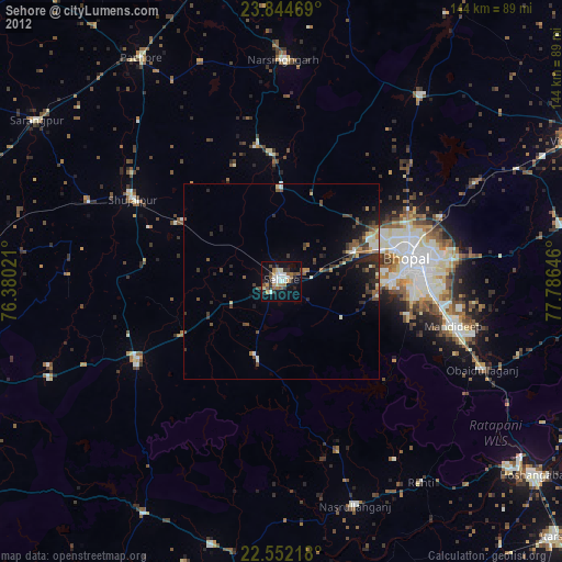
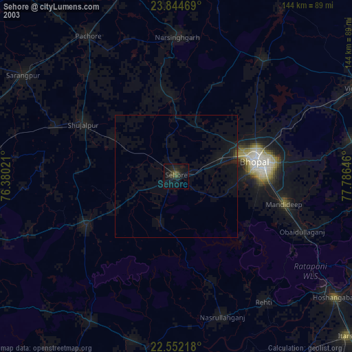
» NASA city lights 2003
» Earth at Night: Flat Maps 2012, 2016