Talen night lights from space
Night Light of Talen (Madhya Pradesh) from space (India) Src. Average luminocity for 10x10km area is 6.0675% and for 50x50km: 8.0613%.
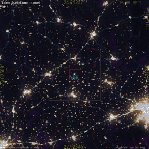
Analysis of Talen night lights 2016
Square area 10x10 km:
 0.4%
0.4%90-99
1.19%80-89
0%70-79
0%60-69
0%50-59
0.6%40-49
2.18%30-39
1.59%20-29
2.38%10-19
4.76%0-9
86.9%Square area 50x50 km:
0.32%90-99
0.75%80-89
0.55%70-79
0.75%60-69
1.24%50-59
1.25%40-49
1.71%30-39
2.41%20-29
2.13%10-19
4.69%0-9
84.2%Clear (daylight) street map image can be seen on geolist.org.
Map coordinates:
24° 12' 44.5" North, 76° 1' 30.3" East
23° 34' 10.2" North, 76° 43' 41.6" East
22° 55' 24.4" North, 77° 25' 52.8" East
Some cities around Talen sort by population:
• Shājāpur
48.6 km =30.2 mi,  250°
250°
• Shujālpur
18.2 km =11.3 mi,  185°
185°
• Biaora
43.2 km =26.8 mi,  25°
25°
• Sārangpur
26 km =16.2 mi,  269°
269°
• Narsinghgarh
40.2 km =25 mi,  67°
67°
• Rājgarh
48.8 km =30.3 mi,  0°
0°
• Akodia
24.8 km =15.4 mi,  212°
212°
• Khujner
26.6 km =16.5 mi,  334°
334°
1255130 (p: 9,818)
Sources (retrieved 2019-11-25):
» Earth at Night: Flat Maps 2012, 2016