Satara night lights from space
Night Light of Satara (Maharashtra) from space (India) Src. Average luminocity for 10x10km area is 47.7479% and for 50x50km: 5.2749%.
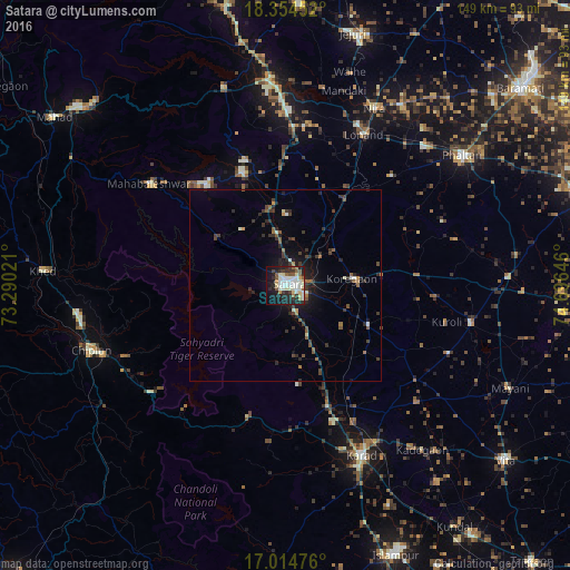
Analysis of Satara night lights 2016
Square area 10x10 km:
 4.55%
4.55%90-99
20.04%80-89
6.4%70-79
2.07%60-69
3.51%50-59
7.64%40-49
1.45%30-39
7.23%20-29
14.05%10-19
26.45%0-9
6.61%Square area 50x50 km:
0.19%90-99
1.14%80-89
0.39%70-79
0.27%60-69
0.5%50-59
1.06%40-49
0.61%30-39
1.53%20-29
1.97%10-19
3.4%0-9
88.96%Clear (daylight) street map image can be seen on geolist.org.
Map coordinates:
18° 21' 16.3" North, 73° 17' 24.8" East
17° 41' 9.2" North, 73° 59' 36" East
17° 0' 53.1" North, 74° 41' 47.3" East
Some cities around Satara sort by population:
• Karād
48.4 km =30.1 mi,  155°
155°
• Wai
31.6 km =19.6 mi,  339°
339°
• Malkapur
50.9 km =31.6 mi, 157°
• Koynanagar
39.8 km =24.7 mi,  217°
217°
• Rahimatpur
24.2 km =15 mi,  115°
115°
• Pānchgani
33.5 km =20.8 mi,  322°
322°
• Shirwal
51.7 km =32.1 mi,  358°
358°
• Pātan
35.9 km =22.3 mi,  195°
195°
1257055 (p: 112,793)
Sources (retrieved 2019-11-25):
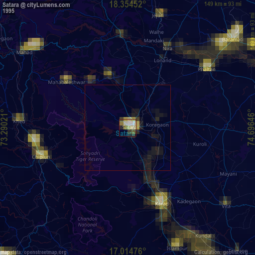
» NASA, Earths city lights 1995
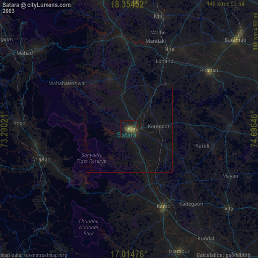
» NASA city lights 2003
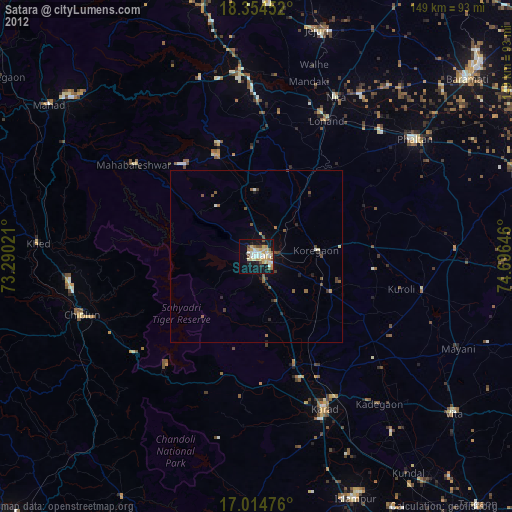
» Earth at Night: Flat Maps 2012, 2016