Rahimatpur night lights from space
Night Light of Rahimatpur (Maharashtra) from space (India) Src. Average luminocity for 10x10km area is 3.5062% and for 50x50km: 5.6843%.
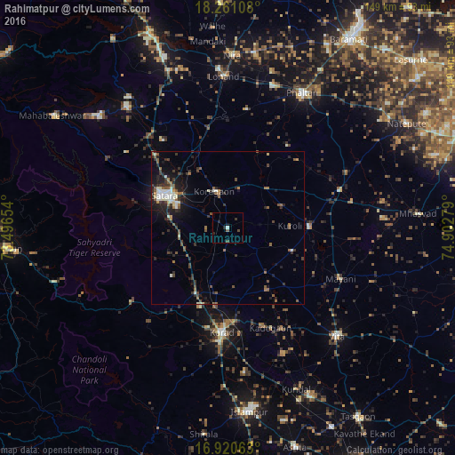
Analysis of Rahimatpur night lights 2016
Square area 10x10 km:
 0%
0%90-99
0.83%80-89
0%70-79
0%60-69
0%50-59
0.83%40-49
1.65%30-39
0.83%20-29
2.07%10-19
1.24%0-9
92.56%Square area 50x50 km:
0.19%90-99
1.19%80-89
0.41%70-79
0.23%60-69
0.78%50-59
1.38%40-49
0.84%30-39
1.51%20-29
1.96%10-19
3.33%0-9
88.18%Clear (daylight) street map image can be seen on geolist.org.
Map coordinates:
18° 15' 39.9" North, 73° 29' 47.5" East
17° 35' 31.6" North, 74° 11' 58.8" East
16° 55' 14.3" North, 74° 54' 10" East
Some cities around Rahimatpur sort by population:
• Satara
24.2 km =15 mi,  295°
295°
• Karād
33.7 km =20.9 mi,  183°
183°
• Phaltan
50.7 km =31.5 mi,  28°
28°
• Vite
50.4 km =31.3 mi,  134°
134°
• Wai
51.8 km =32.2 mi,  320°
320°
• Malkapur
36.8 km =22.9 mi, 183°
• Koynanagar
50.6 km =31.4 mi,  245°
245°
• Pātan
39.8 km =24.7 mi,  232°
232°
1259026 (p: 17,260)
Sources (retrieved 2019-11-25):
» Earth at Night: Flat Maps 2012, 2016