Sahaswān night lights from space
Night Light of Sahaswān (Uttar Pradesh) from space (India) Src. Average luminocity for 10x10km area is 7.9223% and for 50x50km: 4.6402%.
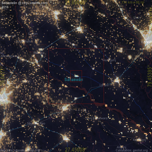
Analysis of Sahaswān night lights 2016
Square area 10x10 km:
 1.52%
1.52%90-99
1.52%80-89
0.95%70-79
0.57%60-69
0.95%50-59
0.95%40-49
0.95%30-39
0.95%20-29
0%10-19
0%0-9
91.67%Square area 50x50 km:
0.13%90-99
0.17%80-89
0.2%70-79
0.58%60-69
0.54%50-59
0.9%40-49
0.9%30-39
1.62%20-29
2.05%10-19
3.05%0-9
89.86%Clear (daylight) street map image can be seen on geolist.org.
Map coordinates:
28° 41' 27.2" North, 78° 2' 51.7" East
28° 4' 20.2" North, 78° 45' 3" East
27° 27' 0.3" North, 79° 27' 14.2" East
Some cities around Sahaswān sort by population:
• Kāsganj
31.1 km =19.3 mi,  199°
199°
• Ujhāni
26.4 km =16.4 mi,  106°
106°
• Bisauli
31.9 km =19.8 mi,  34°
34°
• Islāmnagar
28.7 km =17.8 mi,  354°
354°
• Soron
20.2 km =12.6 mi,  181°
181°
• Bilsi
16.9 km =10.5 mi,  67°
67°
• Sahāwar
31.8 km =19.8 mi,  165°
165°
• Wazīrganj
33.7 km =20.9 mi,  62°
62°
1257800 (p: 60,953)
Sources (retrieved 2019-11-25):
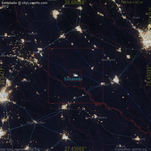
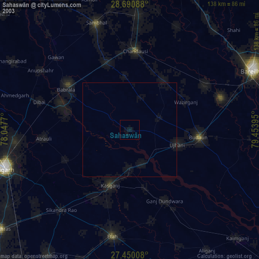
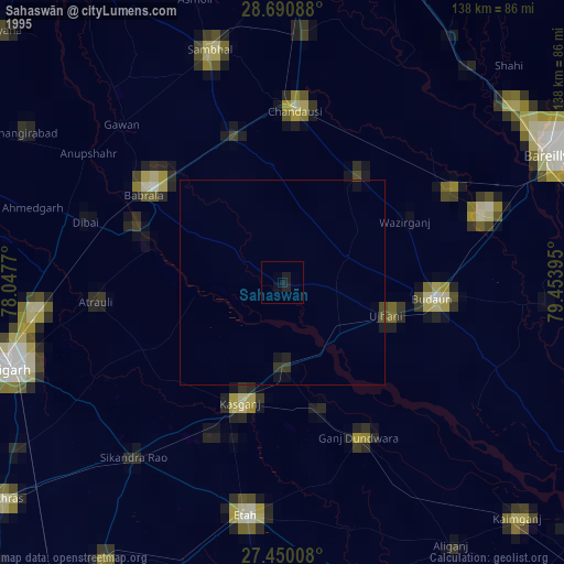
» NASA, Earths city lights 1995
» NASA city lights 2003
» Earth at Night: Flat Maps 2012, 2016