Bilsi night lights from space
Night Light of Bilsi (Uttar Pradesh) from space (India) Src. Average luminocity for 10x10km area is 6.0928% and for 50x50km: 6.3994%.
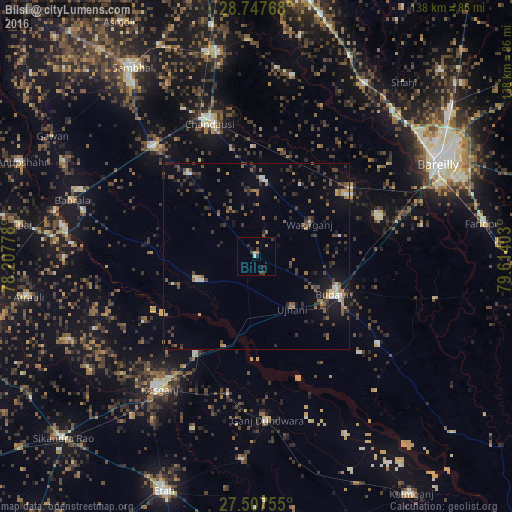
Analysis of Bilsi night lights 2016
Square area 10x10 km:
 0%
0%90-99
0.76%80-89
0.76%70-79
1.33%60-69
0.95%50-59
0%40-49
0.57%30-39
3.98%20-29
1.52%10-19
0.76%0-9
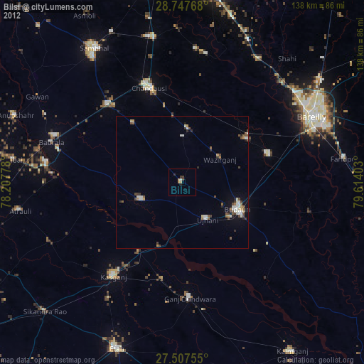
89.39%Square area 50x50 km:
0.3%90-99
0.55%80-89
0.32%70-79
0.58%60-69
0.91%50-59
1.35%40-49
1.34%30-39
1.96%20-29
1.92%10-19
3.52%0-9
87.24%Clear (daylight) street map image can be seen on geolist.org.
Map coordinates:
28° 44' 51.6" North, 78° 12' 28" East
28° 7' 45.9" North, 78° 54' 39.2" East
27° 30' 27.2" North, 79° 36' 50.5" East
Some cities around Bilsi sort by population:
• Budaun
23.5 km =14.6 mi,  115°
115°
• Sahaswān
16.9 km =10.5 mi,  247°
247°
• Ujhāni
17 km =10.6 mi,  145°
145°
• Aonla
29.7 km =18.5 mi,  57°
57°
• Bisauli
20 km =12.4 mi,  7°
7°
• Islāmnagar
28.7 km =17.8 mi,  320°
320°
• Soron
31.1 km =19.3 mi,  211°
211°
• Wazīrganj
17 km =10.6 mi, 57°
1275590 (p: 26,320)
Sources (retrieved 2019-11-25):
» Earth at Night: Flat Maps 2012, 2016