Rājgarh night lights from space
Night Light of Rājgarh (Madhya Pradesh) from space (India) Src. Average luminocity for 10x10km area is 21.1468% and for 50x50km: 2.7409%.
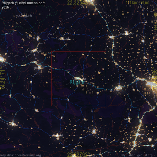
Analysis of Rājgarh night lights 2016
Square area 10x10 km:
 0.6%
0.6%90-99
4.96%80-89
2.38%70-79
2.58%60-69
2.58%50-59
3.37%40-49
2.58%30-39
2.38%20-29
3.77%10-19
15.08%0-9
59.72%Square area 50x50 km:
0.02%90-99
0.2%80-89
0.18%70-79
0.32%60-69
0.34%50-59
0.51%40-49
0.72%30-39
1%20-29
0.95%10-19
1.2%0-9
94.56%Clear (daylight) street map image can be seen on geolist.org.
Map coordinates:
23° 19' 31.5" North, 74° 14' 30.2" East
22° 40' 41.6" North, 74° 56' 41.4" East
22° 1' 40.5" North, 75° 38' 52.7" East
Some cities around Rājgarh sort by population:
• Dhār
37.4 km =23.2 mi,  104°
104°
• Jhābua
37.6 km =23.4 mi,  285°
285°
• Badnāwar
48.3 km =30 mi,  37°
37°
• Petlāwad
40 km =24.9 mi,  337°
337°
• Jobat
48.4 km =30.1 mi,  232°
232°
• Rānāpur
43.6 km =27.1 mi,  265°
265°
• Bamna
50 km =31.1 mi, 337°
• Bāg
38.9 km =24.2 mi,  204°
204°
1258876 (p: 17,113)
Sources (retrieved 2019-11-25):
» Earth at Night: Flat Maps 2012, 2016