Rāj-Nāndgaon night lights from space
Night Light of Rāj-Nāndgaon (Chhattisgarh) from space (India) Src. Average luminocity for 10x10km area is 65.0099% and for 50x50km: 16.1896%.
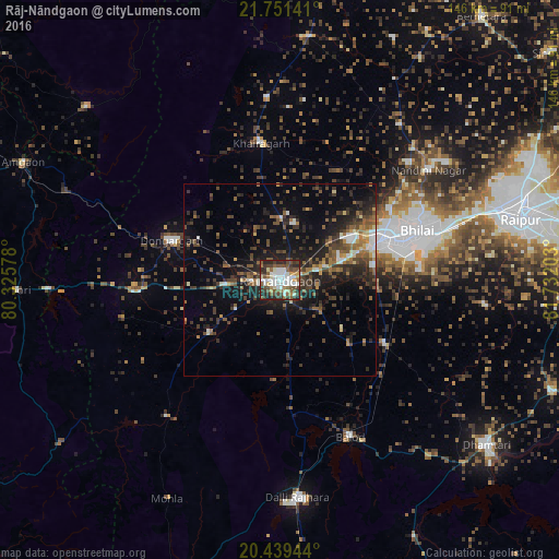
Analysis of Rāj-Nāndgaon night lights 2016
Square area 10x10 km:
 17.66%
90-99
16.67%80-89
3.77%70-79
4.17%60-69
7.74%50-59
14.09%40-49
13.1%30-39
8.93%20-29
13.89%10-19
0%0-9
0%Square area 50x50 km:
1.52%90-99
1.97%80-89
0.88%70-79
1.08%60-69
2.44%50-59
3.43%40-49
3.64%30-39
4.58%20-29
6.19%10-19
10.76%0-9
63.51%Clear (daylight) street map image can be seen on geolist.org.
Map coordinates:
21° 45' 5.1" North, 80° 19' 32.8" East
21° 5' 48.7" North, 81° 1' 44" East
20° 26' 22" North, 81° 43' 55.3" East
Some cities around Rāj-Nāndgaon sort by population:
• Bhilai
43.3 km =26.9 mi,  73°
73°
• Durg
27.7 km =17.2 mi, 67°
• Dongargarh
30.2 km =18.8 mi,  289°
289°
• Balod
44.7 km =27.8 mi,  155°
155°
• Bhānpurī
10 km =6.2 mi,  266°
266°
• Khairāgarh
36.1 km =22.4 mi,  351°
351°
• Dongargaon
23.1 km =14.4 mi,  233°
233°
• Ambāgarh Chauki
46.2 km =28.7 mi,  219°
219°
1258831 (p: 150,755)
Sources (retrieved 2019-11-25):
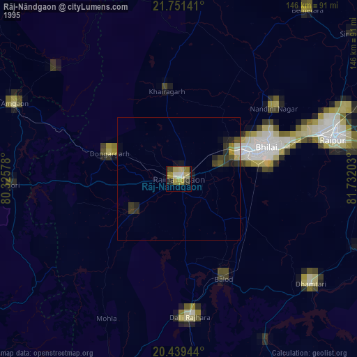
» NASA, Earths city lights 1995
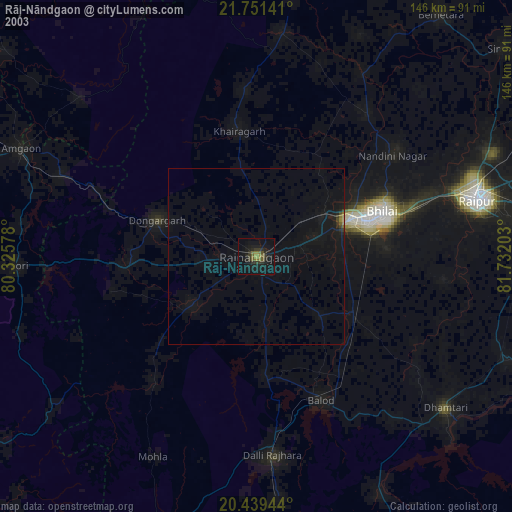
» NASA city lights 2003
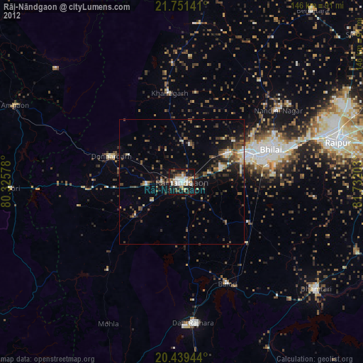
» Earth at Night: Flat Maps 2012, 2016