Bhānpurī night lights from space
Night Light of Bhānpurī (Chhattisgarh) from space (India) Src. Average luminocity for 10x10km area is 28.8115% and for 50x50km: 12.636%.
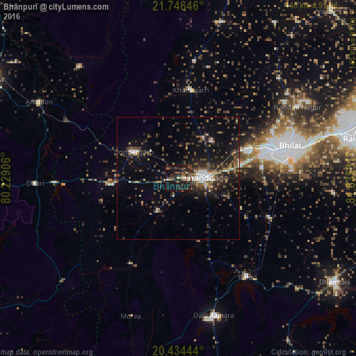
Analysis of Bhānpurī night lights 2016
Square area 10x10 km:
 1.19%
1.19%90-99
3.77%80-89
0.99%70-79
1.59%60-69
3.77%50-59
8.93%40-49
6.75%30-39
7.94%20-29
11.9%10-19
36.11%0-9
17.06%Square area 50x50 km:
1.09%90-99
1.33%80-89
0.45%70-79
0.7%60-69
1.6%50-59
2.55%40-49
3.32%30-39
3.9%20-29
4.58%10-19
9.66%0-9
70.82%Clear (daylight) street map image can be seen on geolist.org.
Map coordinates:
21° 44' 47.3" North, 80° 13' 44.6" East
21° 5' 30.8" North, 80° 55' 55.8" East
20° 26' 4" North, 81° 38' 7.1" East
Some cities around Bhānpurī sort by population:
• Durg
37.4 km =23.2 mi,  72°
72°
• Rāj-Nāndgaon
10 km =6.2 mi,  86°
86°
• Dongargarh
21.3 km =13.2 mi,  300°
300°
• Balod
49.2 km =30.6 mi,  144°
144°
• Khairāgarh
36.7 km =22.8 mi,  7°
7°
• Dongargaon
15.8 km =9.8 mi,  212°
212°
• Ambāgarh Chauki
40 km =24.9 mi, 208°
• Chhuīkhadān
48.4 km =30.1 mi, 8°
1276151 (p: 17,270)
Sources (retrieved 2019-11-25):
» Earth at Night: Flat Maps 2012, 2016