Durg night lights from space
Night Light of Durg (Chhattisgarh) from space (India) Src. Average luminocity for 10x10km area is 87.4722% and for 50x50km: 33.0526%.
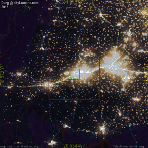
Analysis of Durg night lights 2016
Square area 10x10 km:
 43.25%
90-99
19.44%80-89
8.93%70-79
5.16%60-69
13.89%50-59
7.74%40-49
1.19%30-39
0.4%20-29
0%10-19
0%0-9
0%Square area 50x50 km:
7.2%90-99
4.72%80-89
2.25%70-79
2.73%60-69
5.14%50-59
6.46%40-49
6.9%30-39
6.59%20-29
9.26%10-19
12.61%0-9
36.14%Clear (daylight) street map image can be seen on geolist.org.
Map coordinates:
21° 50' 44.1" North, 80° 34' 23.1" East
21° 11' 29.3" North, 81° 16' 34.3" East
20° 32' 4" North, 81° 58' 45.6" East
Some cities around Durg sort by population:
• Raipur
37.3 km =23.2 mi,  82°
82°
• Bhilai
15.9 km =9.9 mi, 82°
• Rāj-Nāndgaon
27.7 km =17.2 mi,  247°
247°
• Kumhāri
26.3 km =16.3 mi,  71°
71°
• Bhānpurī
37.4 km =23.2 mi, 252°
• Khairāgarh
39.8 km =24.7 mi,  309°
309°
• Pātan
31.9 km =19.8 mi,  123°
123°
• Bhatgaon
44.2 km =27.5 mi,  95°
95°
1272181 (p: 255,283)
Sources (retrieved 2019-11-25):
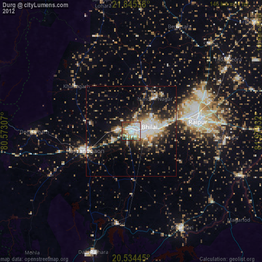
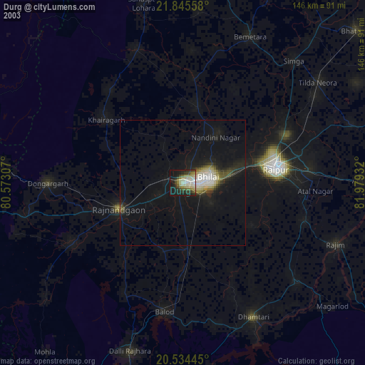
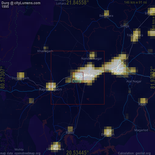
» NASA, Earths city lights 1995
» NASA city lights 2003
» Earth at Night: Flat Maps 2012, 2016