Rāghogarh night lights from space
Night Light of Rāghogarh (Madhya Pradesh) from space (India) Src. Average luminocity for 10x10km area is 45.8313% and for 50x50km: 13.793%.
Analysis of Rāghogarh night lights 2016
Square area 10x10 km:
 9.92%
9.92%90-99
13.49%80-89
3.97%70-79
3.97%60-69
1.79%50-59
4.96%40-49
7.14%30-39
8.33%20-29
13.89%10-19
16.67%0-9
15.87%Square area 50x50 km:
1.73%90-99
2.73%80-89
0.9%70-79
1.35%60-69
1.14%50-59
2.05%40-49
2.3%30-39
2.99%20-29
4.88%10-19
9.37%0-9
70.56%Clear (daylight) street map image can be seen on geolist.org.
Map coordinates:
25° 4' 53.9" North, 76° 29' 40.4" East
24° 26' 35.4" North, 77° 11' 51.6" East
23° 48' 5.3" North, 77° 54' 2.9" East
Some cities around Rāghogarh sort by population:
• Guna
25.4 km =15.8 mi,  26°
26°
• Ashoknagar
56 km =34.8 mi,  74°
74°
• Sironj
62.7 km =39 mi,  127°
127°
• Chhabra
43.4 km =27 mi,  304°
304°
• Āron
23.3 km =14.5 mi,  107°
107°
• Kumbhrāj
17 km =10.6 mi,  242°
242°
• Leteri
47.7 km =29.6 mi,  153°
153°
• Manohar Thāna
46 km =28.6 mi, 240°
1259056 (p: 63,873)
Sources (retrieved 2019-11-25):
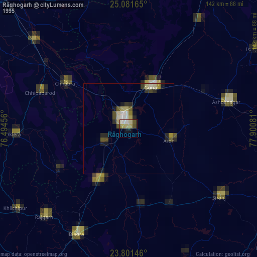
» NASA, Earths city lights 1995
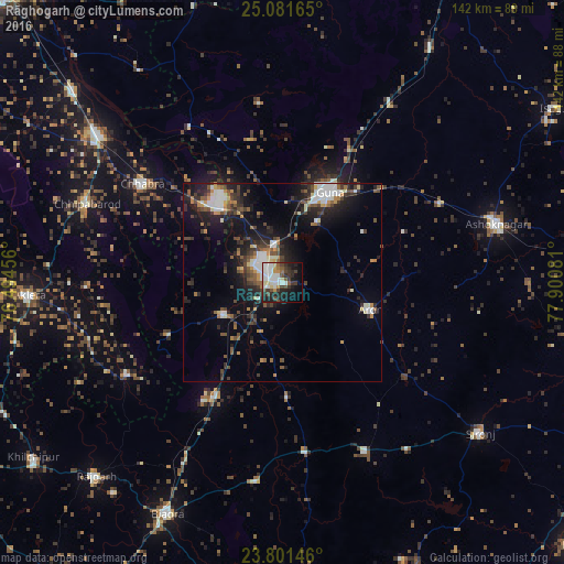
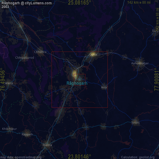
» NASA city lights 2003
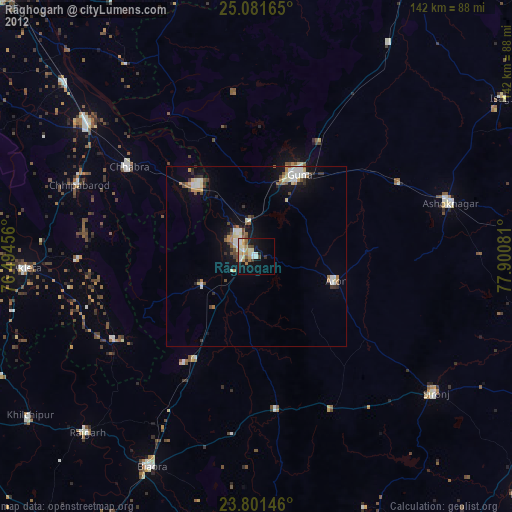
» Earth at Night: Flat Maps 2012, 2016