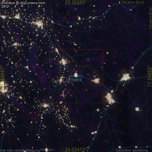
Chhabra night lights from space
Night Light of Chhabra (Rajasthan) from space (India) Src. Average luminocity for 10x10km area is 29.994% and for 50x50km: 13.0536%.
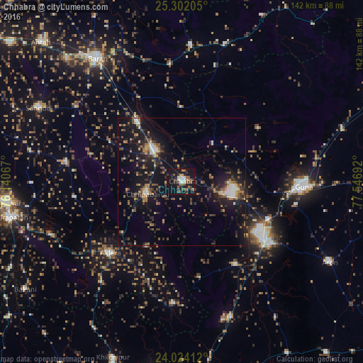
Analysis of Chhabra night lights 2016
Square area 10x10 km:
 2.38%
2.38%90-99
5.56%80-89
1.19%70-79
0.6%60-69
3.77%50-59
10.12%40-49
4.76%30-39
6.94%20-29
6.94%10-19
42.06%0-9
15.67%Square area 50x50 km:
0.78%90-99
1.52%80-89
0.88%70-79
1.31%60-69
1.55%50-59
2.02%40-49
2.8%30-39
3.16%20-29
4.28%10-19
14.95%0-9
66.75%Clear (daylight) street map image can be seen on geolist.org.
Map coordinates:
25° 18' 7.4" North, 76° 8' 26.4" East
24° 39' 53" North, 76° 50' 37.6" East
24° 1' 26.8" North, 77° 32' 48.9" East
Some cities around Chhabra sort by population:
• Guna
47.3 km =29.4 mi,  92°
92°
• Bārān
58.6 km =36.4 mi,  325°
325°
• Rāghogarh
43.4 km =27 mi,  124°
124°
• Sangod
63.4 km =39.4 mi,  297°
297°
• Aklera
39.6 km =24.6 mi,  224°
224°
• Kumbhrāj
38.4 km =23.9 mi,  147°
147°
• Khānpur
45.9 km =28.5 mi,  279°
279°
• Manohar Thāna
47.4 km =29.5 mi,  185°
185°
1274381 (p: 25,676)
Sources (retrieved 2019-11-25):
» Earth at Night: Flat Maps 2012, 2016