Sironj night lights from space
Night Light of Sironj (Madhya Pradesh) from space (India) Src. Average luminocity for 10x10km area is 12.8864% and for 50x50km: 1.9687%.
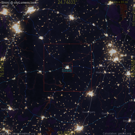
Analysis of Sironj night lights 2016
Square area 10x10 km:
 3.22%
3.22%90-99
1.89%80-89
0.57%70-79
1.14%60-69
1.52%50-59
1.52%40-49
0.95%30-39
0.95%20-29
3.03%10-19
2.65%0-9
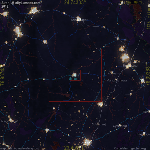
82.58%Square area 50x50 km:
0.16%90-99
0.09%80-89
0.07%70-79
0.13%60-69
0.24%50-59
0.38%40-49
0.63%30-39
0.61%20-29
0.91%10-19
0.73%0-9
96.05%Clear (daylight) street map image can be seen on geolist.org.
Map coordinates:
24° 44' 36" North, 76° 59' 14.7" East
24° 6' 11.3" North, 77° 41' 26" East
23° 27' 35" North, 78° 23' 37.2" East
Some cities around Sironj sort by population:
• Bāsoda
37.5 km =23.3 mi,  138°
138°
• Ashoknagar
52.7 km =32.7 mi,  4°
4°
• Etāwa
52.7 km =32.7 mi,  80°
80°
• Āron
41.5 km =25.8 mi,  318°
318°
• Mungaoli
53.3 km =33.1 mi,  50°
50°
• Leteri
29 km =18 mi,  260°
260°
• Korwai
35.5 km =22.1 mi,  87°
87°
• Bamora
40.8 km =25.4 mi,  97°
97°
1256064 (p: 45,455)
Sources (retrieved 2019-11-25):
» Earth at Night: Flat Maps 2012, 2016