Lalgudi night lights from space
Night Light of Lalgudi (Tamil Nadu) from space (India) Src. Average luminocity for 10x10km area is 14.3571% and for 50x50km: 20.814%.
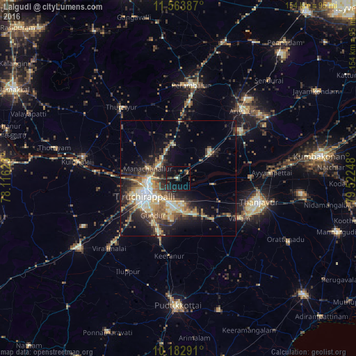
Analysis of Lalgudi night lights 2016
Square area 10x10 km:
 0%
0%90-99
0.87%80-89
0.65%70-79
0.43%60-69
1.52%50-59
3.03%40-49
2.6%30-39
3.46%20-29
5.63%10-19
28.79%0-9
53.03%Square area 50x50 km:
1.39%90-99
3.85%80-89
3.07%70-79
3.42%60-69
2.44%50-59
3.06%40-49
3.71%30-39
3.99%20-29
6.41%10-19
10.52%0-9
58.14%Clear (daylight) street map image can be seen on geolist.org.
Map coordinates:
11° 33' 49.9" North, 78° 6' 58.4" East
10° 52' 27.1" North, 78° 49' 9.7" East
10° 10' 58.5" North, 79° 31' 20.9" East
Some cities around Lalgudi sort by population:
• Tiruchirappalli
14.9 km =9.3 mi,  244°
244°
• Tanjore
36.3 km =22.6 mi,  105°
105°
• Vallam
31.4 km =19.5 mi,  123°
123°
• Thiruvaiyaru
31.1 km =19.3 mi,  87°
87°
• Thirukattupalli
15.3 km =9.5 mi,  102°
102°
• Puliyūr
26.8 km =16.7 mi,  174°
174°
• Pullambādi
12.4 km =7.7 mi,  53°
53°
• Kīranūr
34 km =21.1 mi,  185°
185°
1265163 (p: 20,916)
Sources (retrieved 2019-11-25):
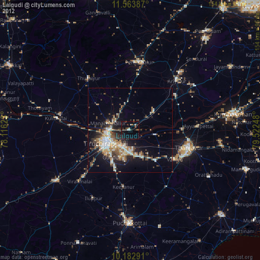
» Earth at Night: Flat Maps 2012, 2016