Pīlibhīt night lights from space
Night Light of Pīlibhīt (Uttar Pradesh) from space (India) Src. Average luminocity for 10x10km area is 35.0833% and for 50x50km: 4.1476%.
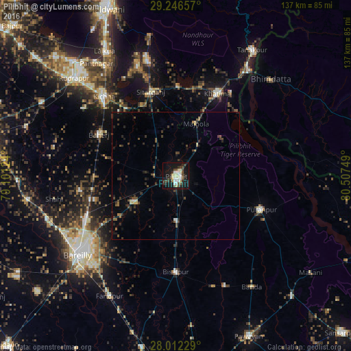
Analysis of Pīlibhīt night lights 2016
Square area 10x10 km:
 6.25%
6.25%90-99
6.25%80-89
6.44%70-79
2.27%60-69
0.76%50-59
3.79%40-49
6.63%30-39
5.3%20-29
7.58%10-19
40.15%0-9
14.58%Square area 50x50 km:
0.33%90-99
0.39%80-89
0.43%70-79
0.18%60-69
0.37%50-59
0.6%40-49
0.9%30-39
1.29%20-29
1.1%10-19
2.96%0-9
91.46%Clear (daylight) street map image can be seen on geolist.org.
Map coordinates:
29° 14' 47.7" North, 79° 6' 4.5" East
28° 37' 52.5" North, 79° 48' 15.7" East
28° 0' 44.2" North, 80° 30' 27" East
Some cities around Pīlibhīt sort by population:
• Baheri
33.9 km =21.1 mi,  297°
297°
• Nawābganj
19.4 km =12.1 mi,  238°
238°
• Sitārganj
34.5 km =21.4 mi,  343°
343°
• Deoraniān
32 km =19.9 mi,  269°
269°
• Richha
28.4 km =17.6 mi,  284°
284°
• Jahānābād
8.4 km =5.2 mi, 269°
• Barkhera Kalān
19.9 km =12.4 mi,  179°
179°
• Kālīnagar
27.1 km =16.8 mi,  92°
92°
1259686 (p: 131,008)
Sources (retrieved 2019-11-25):
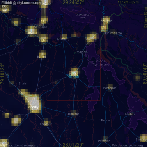
» NASA, Earths city lights 1995
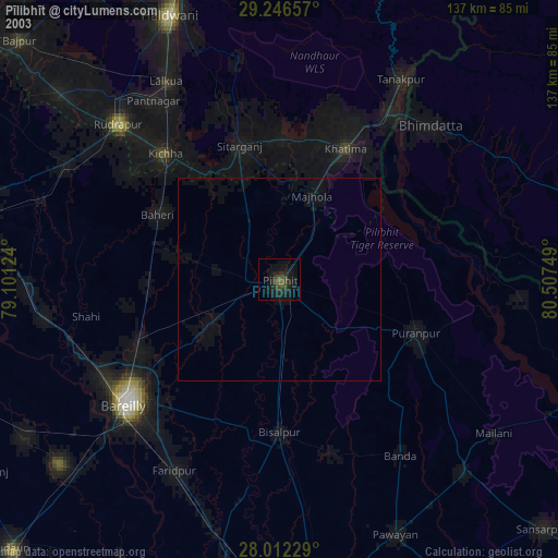
» NASA city lights 2003
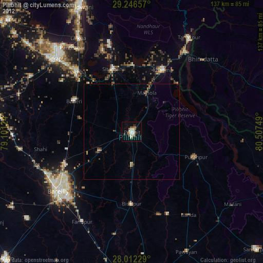
» Earth at Night: Flat Maps 2012, 2016