Pawāyan night lights from space
Night Light of Pawāyan (Uttar Pradesh) from space (India) Src. Average luminocity for 10x10km area is 23.8939% and for 50x50km: 7.3552%.

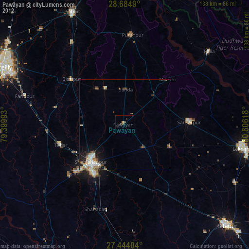
Analysis of Pawāyan night lights 2016
Square area 10x10 km:
 1.89%
1.89%90-99
2.65%80-89
1.7%70-79
2.84%60-69
3.03%50-59
4.55%40-49
5.3%30-39
8.14%20-29
3.98%10-19
20.27%0-9
45.64%Square area 50x50 km:
0.71%90-99
1.15%80-89
0.97%70-79
0.68%60-69
0.87%50-59
0.87%40-49
1.62%30-39
1.96%20-29
2.3%10-19
3.35%0-9
85.52%Clear (daylight) street map image can be seen on geolist.org.
Map coordinates:
28° 41' 5.6" North, 79° 23' 59.7" East
28° 3' 58.5" North, 80° 6' 11" East
27° 26' 38.5" North, 80° 48' 22.2" East
Some cities around Pawāyan sort by population:
• Shāhjānpur
28 km =17.4 mi,  222°
222°
• Bīsalpur
38.6 km =24 mi,  310°
310°
• Gola Gokarannāth
36.1 km =22.4 mi,  87°
87°
• Tilhar
37.6 km =23.4 mi,  252°
252°
• Khūtār
22.4 km =13.9 mi,  47°
47°
• Bilsanda
24.7 km =15.3 mi,  322°
322°
• Mailāni
34.4 km =21.4 mi,  43°
43°
• Mohanpur
25 km =15.5 mi,  33°
33°
1260003 (p: 25,708)
Sources (retrieved 2019-11-25):
» Earth at Night: Flat Maps 2012, 2016