Gola Gokarannāth night lights from space
Night Light of Gola Gokarannāth (Uttar Pradesh) from space (India) Src. Average luminocity for 10x10km area is 24.3731% and for 50x50km: 5.0984%.
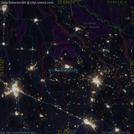
Analysis of Gola Gokarannāth night lights 2016
Square area 10x10 km:
 2.65%
2.65%90-99
5.3%80-89
2.65%70-79
0.76%60-69
2.84%50-59
3.98%40-49
1.89%30-39
3.79%20-29
4.73%10-19
30.3%0-9
41.1%Square area 50x50 km:
0.19%90-99
0.36%80-89
0.27%70-79
0.14%60-69
0.67%50-59
0.8%40-49
1.58%30-39
1.63%20-29
2.33%10-19
3.1%0-9
88.93%Clear (daylight) street map image can be seen on geolist.org.
Map coordinates:
28° 41' 49" North, 79° 46' 2.7" East
28° 4' 42.1" North, 80° 28' 13.9" East
27° 27' 22.4" North, 81° 10' 25.2" East
Some cities around Gola Gokarannāth sort by population:
• Lakhīmpur
33.6 km =20.9 mi,  115°
115°
• Paliā Kalān
40.8 km =25.4 mi,  15°
15°
• Kheri
37.5 km =23.3 mi, 121°
• Pawāyan
36.1 km =22.4 mi,  267°
267°
• Maholi
46.1 km =28.6 mi,  179°
179°
• Khūtār
24 km =14.9 mi,  305°
305°
• Mailāni
26.7 km =16.6 mi,  332°
332°
• Mohanpur
29.4 km =18.3 mi, 311°
1271049 (p: 58,986)
Sources (retrieved 2019-11-25):
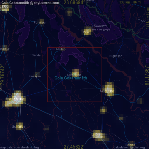
» NASA, Earths city lights 1995
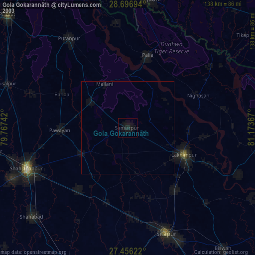
» NASA city lights 2003
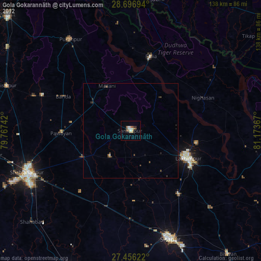
» Earth at Night: Flat Maps 2012, 2016