Mohanpur night lights from space
Night Light of Mohanpur (Uttar Pradesh) from space (India) Src. Average luminocity for 10x10km area is 3.1528% and for 50x50km: 3.7025%.
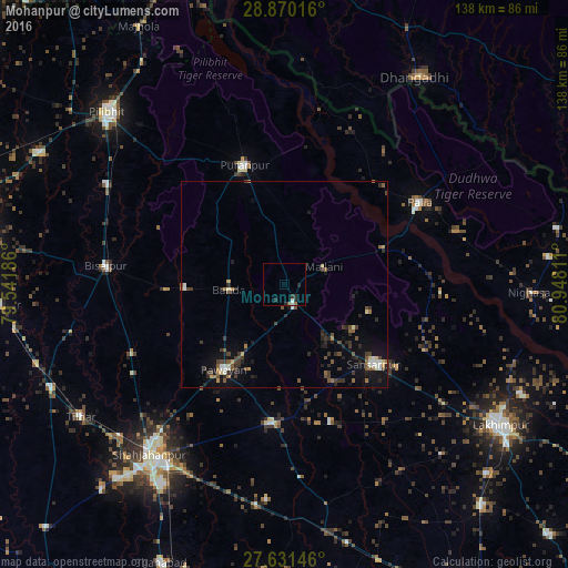
Analysis of Mohanpur night lights 2016
Square area 10x10 km:
 0.2%
0.2%90-99
0.99%80-89
0%70-79
0%60-69
0.4%50-59
0.4%40-49
0%30-39
0.79%20-29
3.57%10-19
0%0-9
93.65%Square area 50x50 km:
0.26%90-99
0.41%80-89
0.28%70-79
0.25%60-69
0.43%50-59
0.77%40-49
0.72%30-39
1.04%20-29
1.23%10-19
2.46%0-9
92.16%Clear (daylight) street map image can be seen on geolist.org.
Map coordinates:
28° 52' 12.6" North, 79° 32' 30.7" East
28° 15' 9.4" North, 80° 14' 41.9" East
27° 37' 53.3" North, 80° 56' 53.2" East
Some cities around Mohanpur sort by population:
• Bīsalpur
43.3 km =26.9 mi,  275°
275°
• Gola Gokarannāth
29.4 km =18.3 mi,  131°
131°
• Pūranpur
30.4 km =18.9 mi,  341°
341°
• Paliā Kalān
38.5 km =23.9 mi,  58°
58°
• Pawāyan
25 km =15.5 mi,  213°
213°
• Khūtār
6 km =3.7 mi,  155°
155°
• Bilsanda
28.8 km =17.9 mi,  267°
267°
• Mailāni
10.6 km =6.6 mi,  66°
66°
1262909 (p: 5,596)
Sources (retrieved 2019-11-25):
» Earth at Night: Flat Maps 2012, 2016