Tilhar night lights from space
Night Light of Tilhar (Uttar Pradesh) from space (India) Src. Average luminocity for 10x10km area is 12.9072% and for 50x50km: 8.5469%.
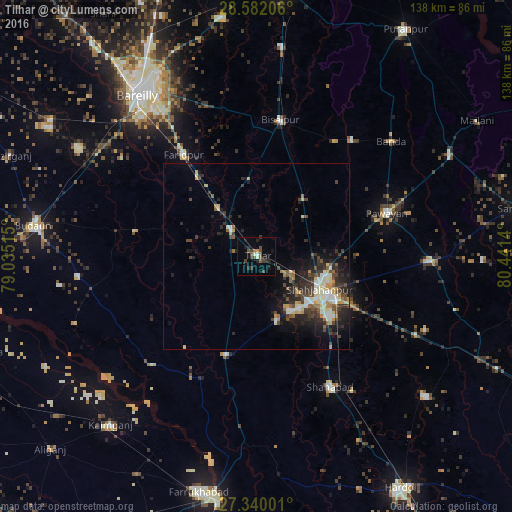
Analysis of Tilhar night lights 2016
Square area 10x10 km:
 0.76%
0.76%90-99
1.33%80-89
0.19%70-79
0.76%60-69
0.76%50-59
2.46%40-49
4.17%30-39
4.55%20-29
4.36%10-19
6.06%0-9
74.62%Square area 50x50 km:
0.72%90-99
1.46%80-89
1.28%70-79
0.77%60-69
0.82%50-59
1.04%40-49
1.74%30-39
1.92%20-29
3.2%10-19
4.84%0-9
82.22%Clear (daylight) street map image can be seen on geolist.org.
Map coordinates:
28° 34' 55.4" North, 79° 2' 6.5" East
27° 57' 46.2" North, 79° 44' 17.8" East
27° 20' 24" North, 80° 26' 29" East
Some cities around Tilhar sort by population:
• Shāhjānpur
19.1 km =11.9 mi,  118°
118°
• Farīdpur
33.6 km =20.9 mi,  324°
324°
• Bīsalpur
37.2 km =23.1 mi,  10°
10°
• Jalālābād
27.5 km =17.1 mi,  197°
197°
• Mīrānpur Katra
10.2 km =6.3 mi, 317°
• Dātāganj
33.1 km =20.6 mi,  282°
282°
• Kānt
17.7 km =11 mi,  162°
162°
• Khudāganj
20.5 km =12.7 mi,  353°
353°
1254481 (p: 57,043)
Sources (retrieved 2019-11-25):
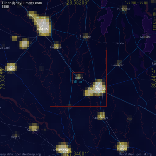
» NASA, Earths city lights 1995
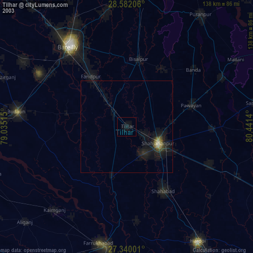
» NASA city lights 2003
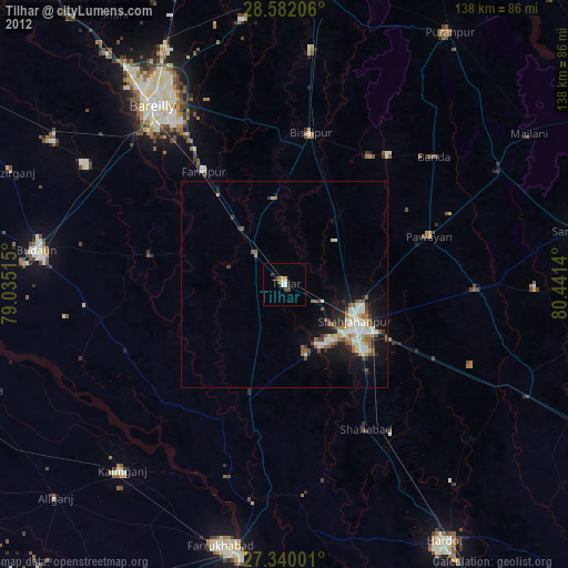
» Earth at Night: Flat Maps 2012, 2016