Pātan night lights from space
Night Light of Pātan (Gujarat) from space (India) Src. Average luminocity for 10x10km area is 27.7659% and for 50x50km: 4.3566%.
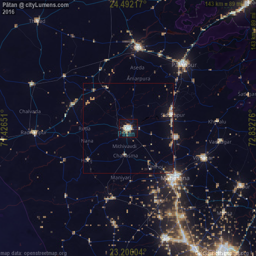
Analysis of Pātan night lights 2016
Square area 10x10 km:
 3.57%
3.57%90-99
6.75%80-89
5.16%70-79
0.4%60-69
3.57%50-59
3.77%40-49
2.98%30-39
1.19%20-29
1.98%10-19
32.14%0-9
38.49%Square area 50x50 km:
0.19%90-99
0.64%80-89
0.51%70-79
0.65%60-69
0.63%50-59
0.62%40-49
0.6%30-39
0.76%20-29
0.74%10-19
3.16%0-9
91.51%Clear (daylight) street map image can be seen on geolist.org.
Map coordinates:
24° 29' 31.8" North, 71° 25' 35.4" East
23° 51' 2.5" North, 72° 7' 46.7" East
23° 12' 21.7" North, 72° 49' 57.9" East
Some cities around Pātan sort by population:
• Dīsa
45.4 km =28.2 mi,  6°
6°
• Visnagar
46.2 km =28.7 mi,  111°
111°
• Unjha
27.1 km =16.8 mi,  101°
101°
• Siddhapur
25.8 km =16 mi,  73°
73°
• Un
36.8 km =22.9 mi,  276°
276°
• Hārij
28.6 km =17.8 mi,  232°
232°
• Chānasma
15.2 km =9.4 mi,  186°
186°
• Kānodar
37.7 km =23.4 mi,  45°
45°
1260173 (p: 117,863)
Sources (retrieved 2019-11-25):
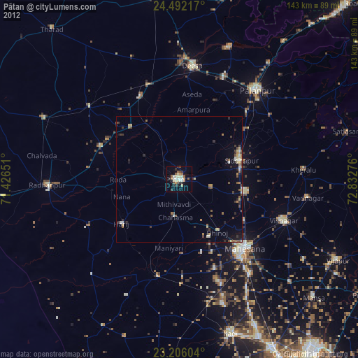
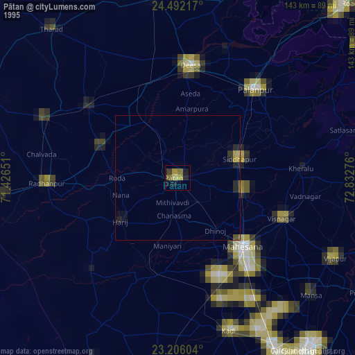
» NASA, Earths city lights 1995
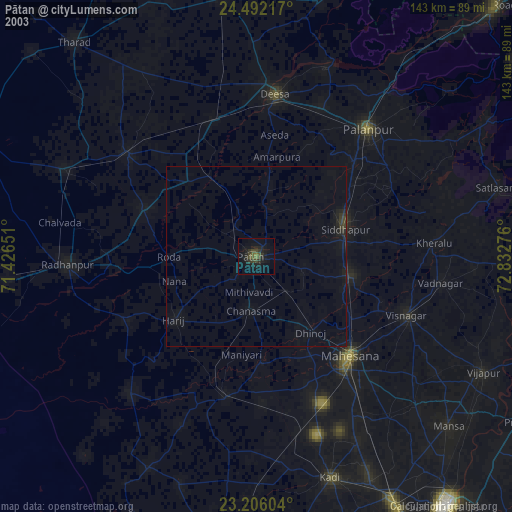
» NASA city lights 2003
» Earth at Night: Flat Maps 2012, 2016