Un night lights from space
Night Light of Un (Gujarat) from space (India) Src. Average luminocity for 10x10km area is 2.8671% and for 50x50km: 2.489%.
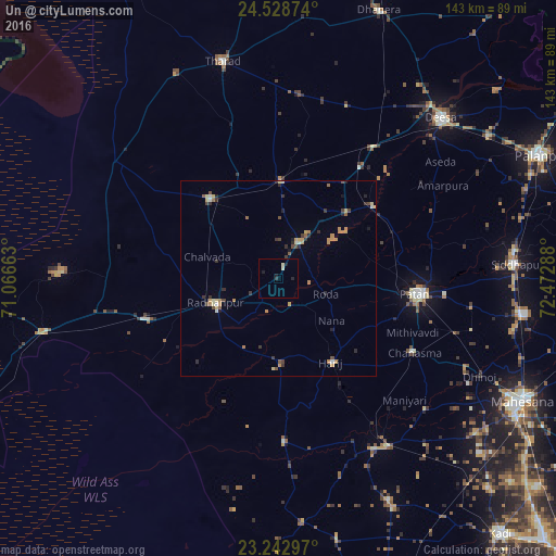
Analysis of Un night lights 2016
Square area 10x10 km:
100  0%
0%
90-99 1.19%
80-89 0.4%
70-79 0%
60-69 0%
50-59 0%
40-49 0%
30-39 0.79%
20-29 0.99%
10-19 2.18%
0-9 94.44%
0%90-99
1.19%80-89
0.4%70-79
0%60-69
0%50-59
0%40-49
0%30-39
0.79%20-29
0.99%10-19
2.18%0-9
94.44%Square area 50x50 km:
100 0.02%
90-99 0.26%
80-89 0.42%
70-79 0.58%
60-69 0.4%
50-59 0.23%
40-49 0.48%
30-39 0.47%
20-29 0.56%
10-19 0.3%
0-9 96.28%
0.02%90-99
0.26%80-89
0.42%70-79
0.58%60-69
0.4%50-59
0.23%40-49
0.48%30-39
0.47%20-29
0.56%10-19
0.3%0-9
96.28%Clear (daylight) street map image can be seen on geolist.org.
Map coordinates:
24° 31' 43.5" North, 71° 3' 59.9" East
23° 53' 14.8" North, 71° 46' 11.1" East
23° 14' 34.7" North, 72° 28' 22.4" East
Some cities around Un sort by population:
• Pātan
36.8 km =22.9 mi,  96°
96°
• Dīsa
58.4 km =36.3 mi,  45°
45°
• Unjha
63.9 km =39.7 mi, 98°
• Siddhapur
61.3 km =38.1 mi,  86°
86°
• Rādhanpur
17.9 km =11.1 mi,  249°
249°
• Tharād
58.4 km =36.3 mi,  345°
345°
• Hārij
25.7 km =16 mi,  147°
147°
• Chānasma
39.8 km =24.7 mi,  118°
118°
1253786 (p: 30,671)
Sources (retrieved 2019-11-25):
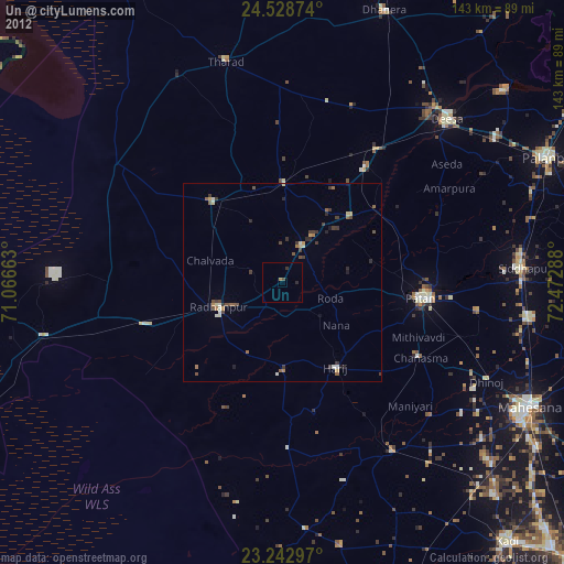
» Earth at Night: Flat Maps 2012, 2016