Padampur night lights from space
Night Light of Padampur (Odisha) from space (India) Src. Average luminocity for 10x10km area is 17.7976% and for 50x50km: 1.2587%.
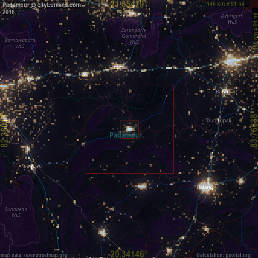
Analysis of Padampur night lights 2016
Square area 10x10 km:
 3.17%
3.17%90-99
2.38%80-89
0.2%70-79
2.18%60-69
1.59%50-59
2.58%40-49
2.18%30-39
4.17%20-29
7.14%10-19
6.15%0-9
68.25%Square area 50x50 km:
0.13%90-99
0.1%80-89
0.01%70-79
0.12%60-69
0.06%50-59
0.14%40-49
0.26%30-39
0.58%20-29
0.76%10-19
0.52%0-9
97.33%Clear (daylight) street map image can be seen on geolist.org.
Map coordinates:
21° 39' 15.4" North, 82° 21' 36.5" East
20° 59' 57.6" North, 83° 3' 47.7" East
20° 20' 29.3" North, 83° 45' 59" East
Some cities around Padampur sort by population:
• Balāngīr
55.2 km =34.3 mi,  126°
126°
• Kantābānji
61 km =37.9 mi,  194°
194°
• Barpāli
58.3 km =36.2 mi,  68°
68°
• Patnāgarh
33.1 km =20.6 mi,  167°
167°
• Saraipali
35.6 km =22.1 mi,  350°
350°
• Sārangarh
65.3 km =40.6 mi,  1°
1°
• Basna
39.6 km =24.6 mi,  321°
321°
• Pithora
63.1 km =39.2 mi,  296°
296°
1260940 (p: 16,387)
Sources (retrieved 2019-11-25):
» Earth at Night: Flat Maps 2012, 2016