Balāngīr night lights from space
Night Light of Balāngīr (Odisha) from space (India) Src. Average luminocity for 10x10km area is 57.661% and for 50x50km: 5.6993%.
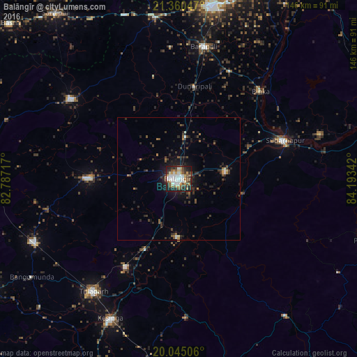
Analysis of Balāngīr night lights 2016
Square area 10x10 km:
 14.58%
90-99
13.83%80-89
2.08%70-79
8.52%60-69
4.17%50-59
11.55%40-49
7.58%30-39
10.8%20-29
13.45%10-19
13.45%0-9
0%Square area 50x50 km:
0.71%90-99
0.69%80-89
0.18%70-79
0.57%60-69
0.5%50-59
0.99%40-49
0.88%30-39
1.71%20-29
2.63%10-19
3.72%0-9
87.43%Clear (daylight) street map image can be seen on geolist.org.
Map coordinates:
21° 21' 37.7" North, 82° 47' 13.8" East
20° 42' 15.1" North, 83° 29' 25" East
20° 2' 42.2" North, 84° 11' 36.3" East
Some cities around Balāngīr sort by population:
• Titlāgarh
58 km =36 mi,  217°
217°
• Barpāli
55 km =34.2 mi,  10°
10°
• Patnāgarh
37.2 km =23.1 mi,  270°
270°
• Sonepur
46.6 km =29 mi,  72°
72°
• Kesinga
64 km =39.8 mi,  206°
206°
• Padampur
55.2 km =34.3 mi,  306°
306°
• Binka
49 km =30.4 mi,  43°
43°
• Tarabha
19.4 km =12.1 mi,  80°
80°
1277643 (p: 91,241)
Sources (retrieved 2019-11-25):
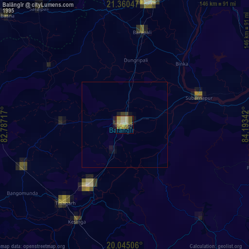
» NASA, Earths city lights 1995
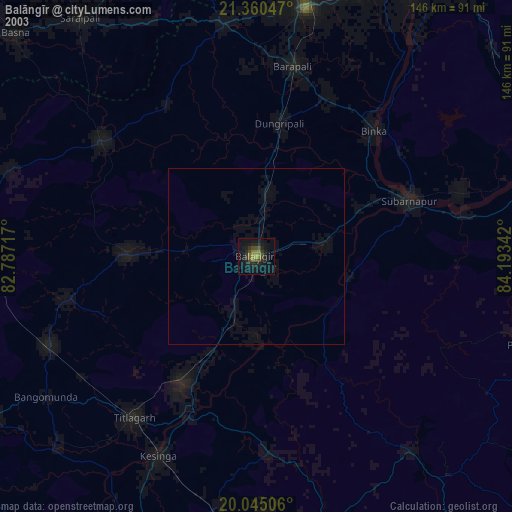
» NASA city lights 2003
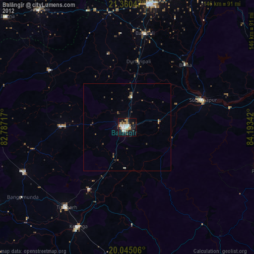
» Earth at Night: Flat Maps 2012, 2016