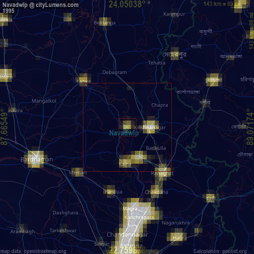
Navadwīp night lights from space
Night Light of Navadwīp (West Bengal) from space (India) Src. Average luminocity for 10x10km area is 42.1098% and for 50x50km: 20.2921%.
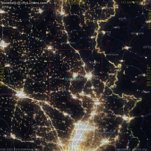
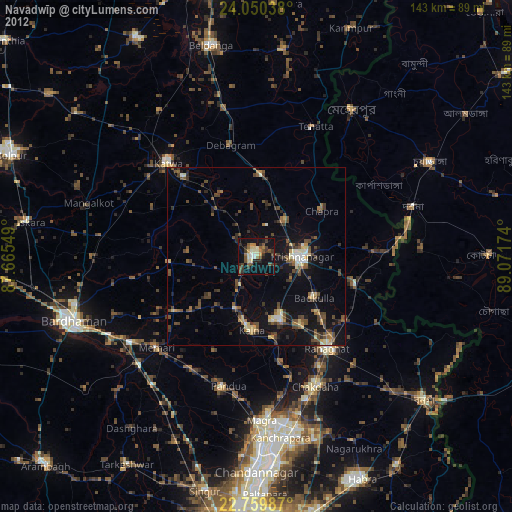
Analysis of Navadwīp night lights 2016
Square area 10x10 km:
 2.46%
2.46%90-99
8.14%80-89
3.03%70-79
6.25%60-69
5.87%50-59
6.25%40-49
9.28%30-39
13.26%20-29
23.3%10-19
21.97%0-9
0.19%Square area 50x50 km:
0.82%90-99
2.64%80-89
1.26%70-79
1.91%60-69
2.21%50-59
3.51%40-49
5.69%30-39
5.48%20-29
10.44%10-19
17.87%0-9
48.16%Clear (daylight) street map image can be seen on geolist.org.
Map coordinates:
24° 3' 1.4" North, 87° 39' 55.8" East
23° 24' 24.1" North, 88° 22' 7" East
22° 45' 35.5" North, 89° 4' 18.3" East
Some cities around Navadwīp sort by population:
• Shāntipur
18.9 km =11.7 mi,  159°
159°
• Krishnanagar
12.5 km =7.8 mi,  90°
90°
• Kātoya
35.8 km =22.2 mi,  317°
317°
• Rānāghāt
32.6 km =20.3 mi,  141°
141°
• Kālna
20.8 km =12.9 mi,  181°
181°
• Bagulā
28.9 km =18 mi,  105°
105°
• Aistala
33.2 km =20.6 mi, 139°
• Muragācha
14.6 km =9.1 mi,  10°
10°
1261669 (p: 111,123)
Sources (retrieved 2019-11-25):
» NASA, Earths city lights 1995
» NASA city lights 2003
» Earth at Night: Flat Maps 2012, 2016