Aistala night lights from space
Night Light of Aistala (West Bengal) from space (India) Src. Average luminocity for 10x10km area is 62.3523% and for 50x50km: 30.8595%.
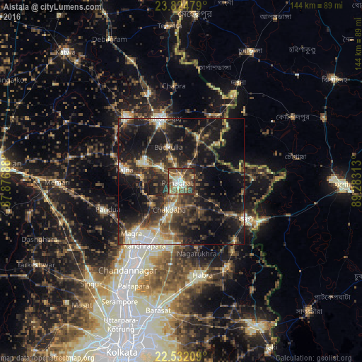
Analysis of Aistala night lights 2016
Square area 10x10 km:
 4.92%
4.92%90-99
15.91%80-89
7.58%70-79
8.33%60-69
8.14%50-59
20.83%40-49
18.94%30-39
10.23%20-29
4.92%10-19
0.19%0-9
0%Square area 50x50 km:
1.81%90-99
5.78%80-89
2.61%70-79
3.01%60-69
3.59%50-59
5.19%40-49
7.64%30-39
8.55%20-29
13.38%10-19
23.31%0-9
25.13%Clear (daylight) street map image can be seen on geolist.org.
Map coordinates:
23° 49' 29.2" North, 87° 52' 36.8" East
23° 10' 48" North, 88° 34' 48" East
22° 31' 55.5" North, 89° 16' 59.3" East
Some cities around Aistala sort by population:
• Shāntipur
16.8 km =10.4 mi,  296°
296°
• Krishnanagar
26.7 km =16.6 mi,  340°
340°
• Kalyani
24 km =14.9 mi,  204°
204°
• Rānāghāt
1.4 km =0.9 mi,  252°
252°
• Kālna
22.6 km =14 mi,  281°
281°
• Bagulā
18.5 km =11.5 mi,  19°
19°
• Madanpur
21.4 km =13.3 mi,  205°
205°
• Haringhāta
23.9 km =14.9 mi,  181°
181°
7302860 (p: 19,425)
Sources (retrieved 2019-11-25):
» Earth at Night: Flat Maps 2012, 2016