Nārnaul night lights from space
Night Light of Nārnaul (Haryana) from space (India) Src. Average luminocity for 10x10km area is 37.536% and for 50x50km: 8.9091%.
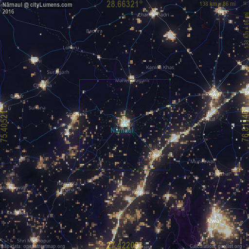
Analysis of Nārnaul night lights 2016
Square area 10x10 km:
 3.79%
3.79%90-99
7.77%80-89
8.33%70-79
3.41%60-69
3.98%50-59
3.98%40-49
6.82%30-39
2.84%20-29
7.95%10-19
38.64%0-9
12.5%Square area 50x50 km:
0.29%90-99
0.78%80-89
1.18%70-79
0.8%60-69
1.05%50-59
1.53%40-49
1.78%30-39
2.22%20-29
2.67%10-19
8.34%0-9
79.36%Clear (daylight) street map image can be seen on geolist.org.
Map coordinates:
28° 39' 47.6" North, 75° 24' 18.8" East
28° 2' 40" North, 76° 6' 30" East
27° 25' 19.5" North, 76° 48' 41.3" East
Some cities around Nārnaul sort by population:
• Kotputli
39.1 km =24.3 mi,  166°
166°
• Neem ka Thana
46.3 km =28.8 mi,  223°
223°
• Behror
24.3 km =15.1 mi,  135°
135°
• Mahendragarh
25.4 km =15.8 mi,  9°
9°
• Khetri
32 km =19.9 mi,  261°
261°
• Bāwal
46.7 km =29 mi,  86°
86°
• Kanīna Khās
37.5 km =23.3 mi,  31°
31°
• Ateli Mandi
16.1 km =10 mi,  67°
67°
1261772 (p: 66,049)
Sources (retrieved 2019-11-25):
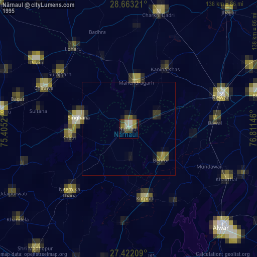
» NASA, Earths city lights 1995
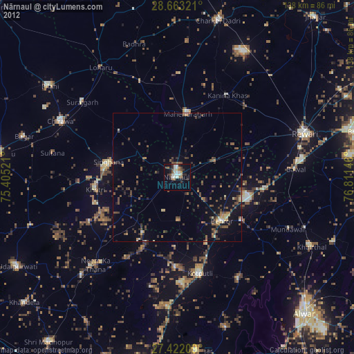
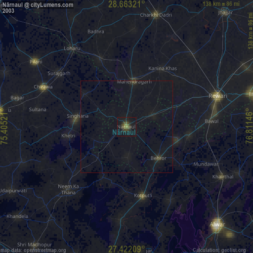
» NASA city lights 2003
» Earth at Night: Flat Maps 2012, 2016