Nagpur night lights from space
Night Light of Nagpur (Maharashtra) from space (India) Src. Average luminocity for 10x10km area is 99.9147% and for 50x50km: 40.2376%.
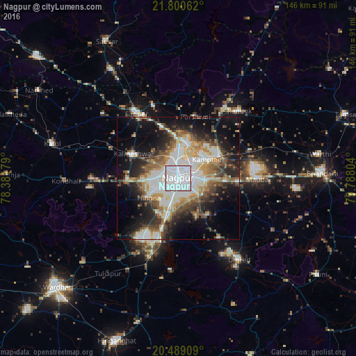
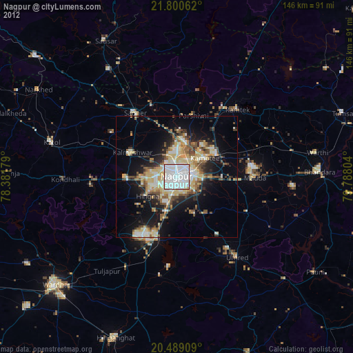
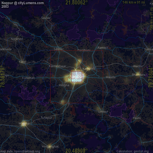
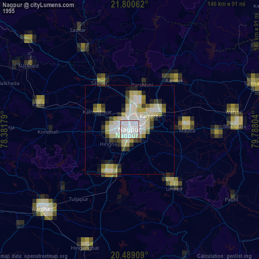
Analysis of Nagpur night lights 2016
Square area 10x10 km:
 92.66%
90-99
7.34%80-89
0%70-79
0%60-69
0%50-59
0%40-49
0%30-39
0%20-29
0%10-19
0%0-9
0%Square area 50x50 km:
11.27%90-99
7.85%80-89
3.51%70-79
4.1%60-69
4.75%50-59
5.38%40-49
5.5%30-39
5.42%20-29
8.3%10-19
14.33%0-9
29.59%Clear (daylight) street map image can be seen on geolist.org.
Map coordinates:
21° 48' 2.2" North, 78° 22' 54.4" East
21° 8' 46.7" North, 79° 5' 5.7" East
20° 29' 20.7" North, 79° 47' 16.9" East
Some cities around Nagpur sort by population:
• Kāmthi
14 km =8.7 mi,  56°
56°
• Saoner
31.5 km =19.6 mi,  327°
327°
• Rāmtek
37.4 km =23.2 mi,  42°
42°
• Kalmeshwar
19.6 km =12.2 mi,  299°
299°
• Khāpa
32.5 km =20.2 mi,  340°
340°
• Kāndri
36.4 km =22.6 mi,  33°
33°
• Mohpa
32.1 km =19.9 mi, 304°
• Mansar
33.4 km =20.8 mi, 33°
1262180 (p: 2,228,018)
Sources (retrieved 2019-11-25):
» NASA, Earths city lights 1995
» NASA city lights 2003
» Earth at Night: Flat Maps 2012, 2016