Khāpa night lights from space
Night Light of Khāpa (Maharashtra) from space (India) Src. Average luminocity for 10x10km area is 14.6402% and for 50x50km: 15.2846%.
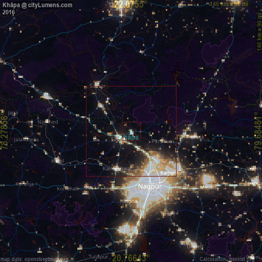
Analysis of Khāpa night lights 2016
Square area 10x10 km:
 1.52%
1.52%90-99
2.65%80-89
0.57%70-79
0.95%60-69
0.95%50-59
1.14%40-49
3.03%30-39
2.46%20-29
1.33%10-19
25%0-9
60.42%Square area 50x50 km:
2.47%90-99
2.87%80-89
1.62%70-79
1.86%60-69
1.69%50-59
2.35%40-49
2.21%30-39
2.27%20-29
3.29%10-19
7.97%0-9
71.42%Clear (daylight) street map image can be seen on geolist.org.
Map coordinates:
22° 4' 31.8" North, 78° 16' 42.8" East
21° 25' 20.7" North, 78° 58' 54" East
20° 45' 59.1" North, 79° 41' 5.3" East
Some cities around Khāpa sort by population:
• Kāmthi
32 km =19.9 mi,  135°
135°
• Saoner
7.5 km =4.7 mi,  236°
236°
• Sausar
32.2 km =20 mi,  323°
323°
• Kalmeshwar
22.1 km =13.7 mi,  196°
196°
• Lodhīkheda
21.8 km =13.5 mi, 324°
• Kāndri
30.5 km =19 mi,  90°
90°
• Mohpa
20.1 km =12.5 mi,  231°
231°
• Mansar
29.3 km =18.2 mi,  95°
95°
1267006 (p: 15,175)
Sources (retrieved 2019-11-25):
» Earth at Night: Flat Maps 2012, 2016