Nābha night lights from space
Night Light of Nābha (Punjab) from space (India) Src. Average luminocity for 10x10km area is 39.793% and for 50x50km: 14.0643%.
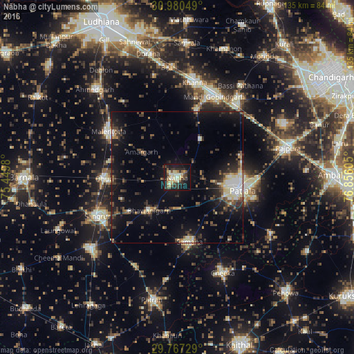
Analysis of Nābha night lights 2016
Square area 10x10 km:
 1.65%
1.65%90-99
9.71%80-89
7.88%70-79
5.68%60-69
2.75%50-59
4.03%40-49
7.51%30-39
9.34%20-29
10.07%10-19
32.97%0-9
8.42%Square area 50x50 km:
1.04%90-99
2.05%80-89
1.68%70-79
1.15%60-69
1.07%50-59
1.74%40-49
3.08%30-39
3.25%20-29
4.55%10-19
12.28%0-9
68.11%Clear (daylight) street map image can be seen on geolist.org.
Map coordinates:
30° 58' 49.8" North, 75° 26' 59.3" East
30° 22' 32.8" North, 76° 9' 10.5" East
29° 46' 2.2" North, 76° 51' 21.8" East
Some cities around Nābha sort by population:
• Patiāla
23.4 km =14.5 mi,  100°
100°
• Māler Kotla
31.4 km =19.5 mi,  303°
303°
• Sangrūr
32.9 km =20.4 mi,  243°
243°
• Dhūri
27.4 km =17 mi,  268°
268°
• Bhawānīgarh
16.3 km =10.1 mi,  222°
222°
• Sanaur
30.4 km =18.9 mi,  105°
105°
• Amloh
26.9 km =16.7 mi,  16°
16°
• Chīma
35 km =21.7 mi,  349°
349°
1262319 (p: 64,640)
Sources (retrieved 2019-11-25):
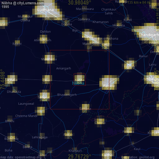
» NASA, Earths city lights 1995
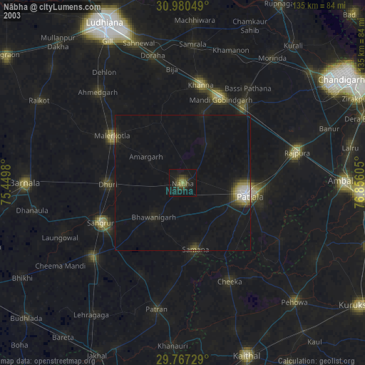
» NASA city lights 2003
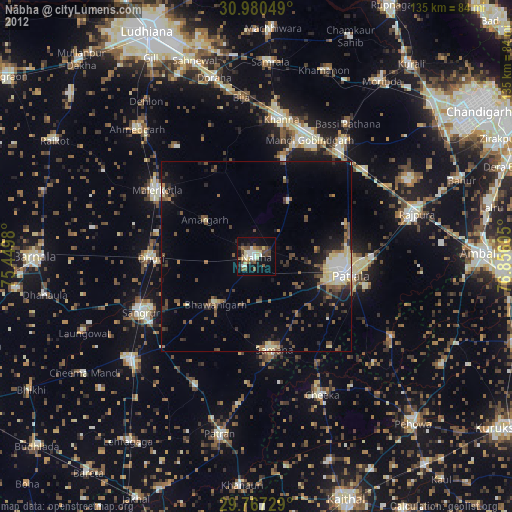
» Earth at Night: Flat Maps 2012, 2016