Murādnagar night lights from space
Night Light of Murādnagar (Uttar Pradesh) from space (India) Src. Average luminocity for 10x10km area is 74.214% and for 50x50km: 63.7922%.
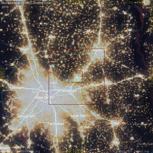
Analysis of Murādnagar night lights 2016
Square area 10x10 km:
 8.9%
8.9%90-99
18.94%80-89
21.59%70-79
8.52%60-69
17.42%50-59
12.5%40-49
7.58%30-39
2.65%20-29
1.89%10-19
0%0-9
0%Square area 50x50 km:
16.15%90-99
14.04%80-89
11.42%70-79
5.53%60-69
7.8%50-59
8.46%40-49
8.92%30-39
8.24%20-29
10.77%10-19
8.67%0-9
0%Clear (daylight) street map image can be seen on geolist.org.
Map coordinates:
29° 23' 42.5" North, 76° 47' 43.9" East
28° 46' 50.5" North, 77° 29' 55.1" East
28° 9' 45.4" North, 78° 12' 6.4" East
Some cities around Murādnagar sort by population:
• Ghāziābād
14.1 km =8.8 mi,  204°
204°
• Loni
20.6 km =12.8 mi,  260°
260°
• Pilkhua
17.1 km =10.6 mi,  116°
116°
• Khekra
22.9 km =14.2 mi,  294°
294°
• Dāsna
11.7 km =7.3 mi,  168°
168°
• Kharkhauda
24.5 km =15.2 mi,  75°
75°
• Farīdnagar
12.8 km =8 mi,  95°
95°
• Niwāri
11.3 km =7 mi,  19°
19°
1262453 (p: 89,482)
Sources (retrieved 2019-11-25):
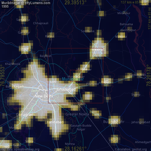
» NASA, Earths city lights 1995
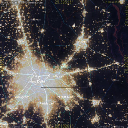
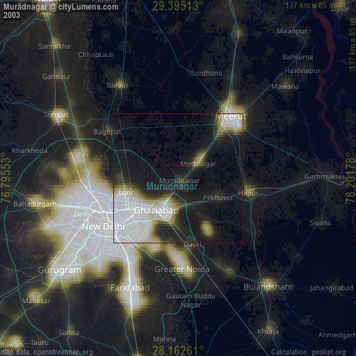
» NASA city lights 2003
» Earth at Night: Flat Maps 2012, 2016