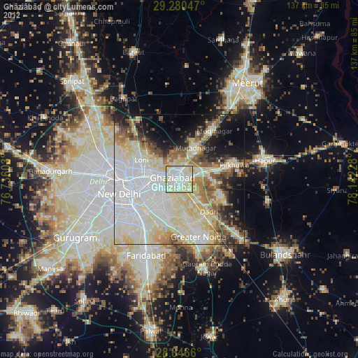
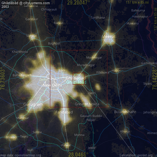
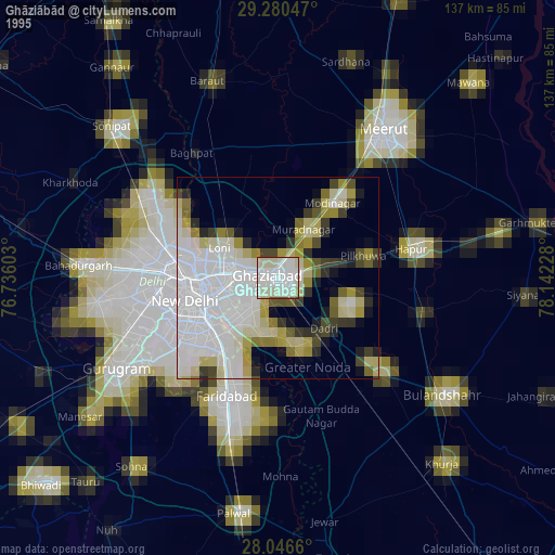
Ghāziābād night lights from space
Night Light of Ghāziābād (Uttar Pradesh) from space (India) Src. Average luminocity for 10x10km area is 97.7973% and for 50x50km: 76.4058%.
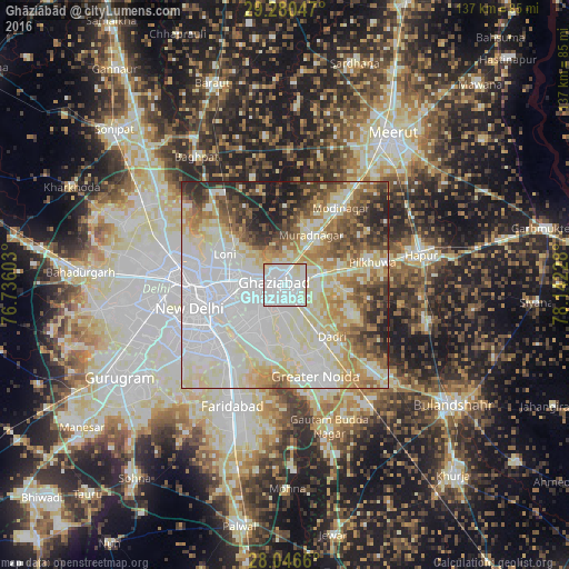
Analysis of Ghāziābād night lights 2016
Square area 10x10 km:
 54.36%
90-99
38.64%80-89
7.01%70-79
0%60-69
0%50-59
0%40-49
0%30-39
0%20-29
0%10-19
0%0-9
0%Square area 50x50 km:
26.06%90-99
20.15%80-89
14.21%70-79
5.82%60-69
7.5%50-59
6.55%40-49
5.97%30-39
4.85%20-29
5.53%10-19
3.35%0-9
0%Clear (daylight) street map image can be seen on geolist.org.
Map coordinates:
29° 16' 49.7" North, 76° 44' 9.7" East
28° 39' 55.3" North, 77° 26' 20.9" East
28° 2' 47.8" North, 78° 8' 32.2" East
Some cities around Ghāziābād sort by population:
• Delhi
20.3 km =12.6 mi,  265°
265°
• New Delhi
21.2 km =13.2 mi,  261°
261°
• Greater Noida
21.1 km =13.1 mi,  153°
153°
• Noida
14.3 km =8.9 mi,  228°
228°
• Loni
17.4 km =10.8 mi,  303°
303°
• Murādnagar
14.1 km =8.8 mi,  24°
24°
• Dādri
16.8 km =10.4 mi,  138°
138°
• Dāsna
8.2 km =5.1 mi,  80°
80°
1271308 (p: 1,199,191)
Sources (retrieved 2019-11-25):
» NASA, Earths city lights 1995
» NASA city lights 2003
» Earth at Night: Flat Maps 2012, 2016