Fāzilka night lights from space
Night Light of Fāzilka (Punjab) from space (India) Src. Average luminocity for 10x10km area is 31.0421% and for 50x50km: 8.9954%.
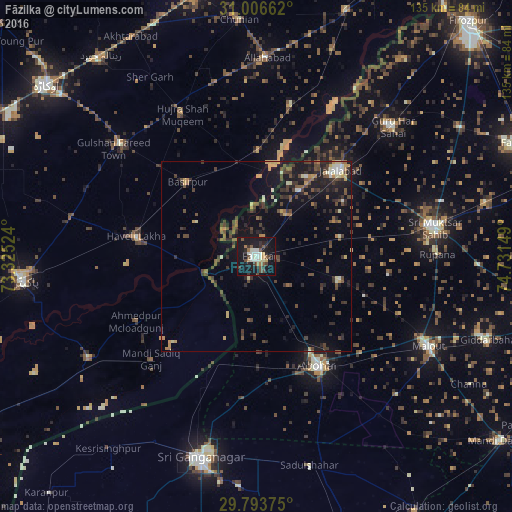
Analysis of Fāzilka night lights 2016
Square area 10x10 km:
 2.56%
2.56%90-99
8.06%80-89
3.11%70-79
1.65%60-69
2.93%50-59
5.13%40-49
4.76%30-39
3.3%20-29
7.69%10-19
47.44%0-9
13.37%Square area 50x50 km:
0.3%90-99
1.05%80-89
0.76%70-79
0.88%60-69
0.86%50-59
1.35%40-49
2.63%30-39
2.27%20-29
3.12%10-19
7.67%0-9
79.11%Clear (daylight) street map image can be seen on geolist.org.
Map coordinates:
31° 0' 23.8" North, 73° 19' 30.9" East
30° 24' 7.5" North, 74° 1' 42.1" East
29° 47' 37.5" North, 74° 43' 53.4" East
Some cities around Fāzilka sort by population:
• Abohar
32.8 km =20.4 mi,  150°
150°
• Muktsar
47.5 km =29.5 mi,  80°
80°
• Dipalpur, PK
46.7 km =29 mi,  309°
309°
• Haveli Lakha, PK
32.5 km =20.2 mi,  279°
279°
• Hujra Shah Muqim, PK
42.6 km =26.5 mi,  332°
332°
• Basirpur, PK
26.6 km =16.5 mi,  317°
317°
• Jalālābād
31.6 km =19.6 mi,  44°
44°
• Kanganpur, PK
41.3 km =25.7 mi,  12°
12°
1271891 (p: 70,887)
Sources (retrieved 2019-11-25):
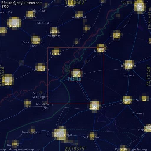
» NASA, Earths city lights 1995
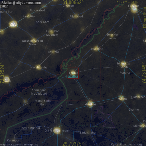
» NASA city lights 2003
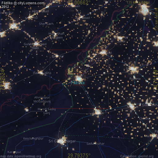
» Earth at Night: Flat Maps 2012, 2016