Māchhīwāra night lights from space
Night Light of Māchhīwāra (Punjab) from space (India) Src. Average luminocity for 10x10km area is 20.8899% and for 50x50km: 18.9358%.
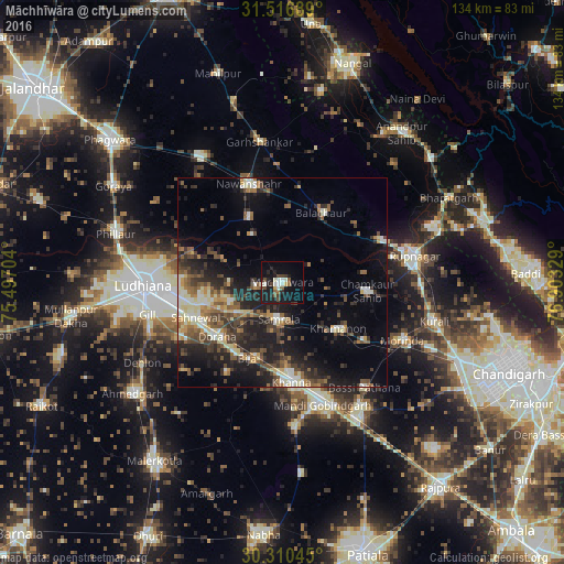
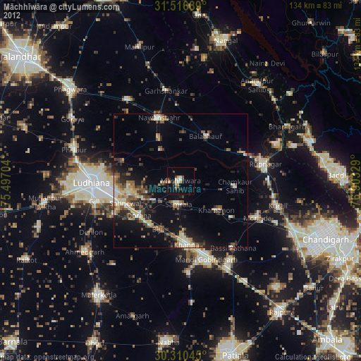
Analysis of Māchhīwāra night lights 2016
Square area 10x10 km:
 1.4%
1.4%90-99
5.59%80-89
0.35%70-79
1.05%60-69
1.57%50-59
2.62%40-49
4.9%30-39
2.1%20-29
5.24%10-19
29.9%0-9
45.28%Square area 50x50 km:
1.4%90-99
3.19%80-89
2.2%70-79
1.72%60-69
2.44%50-59
3.26%40-49
3.91%30-39
3.86%20-29
6.28%10-19
12.49%0-9
59.25%Clear (daylight) street map image can be seen on geolist.org.
Map coordinates:
31° 31' 0.8" North, 75° 29' 49.3" East
30° 54' 56.1" North, 76° 12' 0.6" East
30° 18' 37.6" North, 76° 54' 11.8" East
Some cities around Māchhīwāra sort by population:
• Khanna
23.5 km =14.6 mi,  174°
174°
• Nawanshahr
24.6 km =15.3 mi,  340°
340°
• Dorāha
21.2 km =13.2 mi,  232°
232°
• Bālāchor
18.8 km =11.7 mi,  30°
30°
• Samrāla
8.9 km =5.5 mi,  184°
184°
• Rāhon
17.1 km =10.6 mi,  333°
333°
• Chīma
27.8 km =17.3 mi,  202°
202°
• Khamānon Kalān
18.4 km =11.4 mi,  126°
126°
1264644 (p: 20,447)
Sources (retrieved 2019-11-25):
» Earth at Night: Flat Maps 2012, 2016