Khanna night lights from space
Night Light of Khanna (Punjab) from space (India) Src. Average luminocity for 10x10km area is 56.2587% and for 50x50km: 21.3871%.
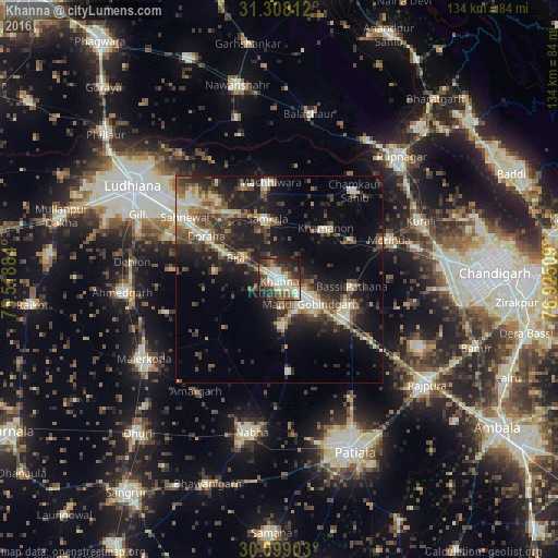
Analysis of Khanna night lights 2016
Square area 10x10 km:
 7.52%
7.52%90-99
13.46%80-89
11.36%70-79
2.62%60-69
6.64%50-59
11.54%40-49
9.79%30-39
11.36%20-29
16.26%10-19
9.27%0-9
0.17%Square area 50x50 km:
1.43%90-99
3.69%80-89
2.95%70-79
1.83%60-69
2.29%50-59
3.79%40-49
4.76%30-39
4.53%20-29
7.64%10-19
14%0-9
53.1%Clear (daylight) street map image can be seen on geolist.org.
Map coordinates:
31° 18' 29.2" North, 75° 31' 7.8" East
30° 42' 19.7" North, 76° 13' 19.1" East
30° 5' 56.5" North, 76° 55' 30.3" East
Some cities around Khanna sort by population:
• Sirhind
17 km =10.6 mi,  114°
114°
• Dorāha
21.7 km =13.5 mi,  298°
298°
• Māchhīwāra
23.5 km =14.6 mi,  354°
354°
• Samrāla
14.8 km =9.2 mi, 349°
• Basi
17.2 km =10.7 mi,  96°
96°
• Amloh
10.8 km =6.7 mi,  174°
174°
• Chīma
13.1 km =8.1 mi,  260°
260°
• Khamānon Kalān
17.8 km =11.1 mi,  45°
45°
1267016 (p: 117,137)
Sources (retrieved 2019-11-25):
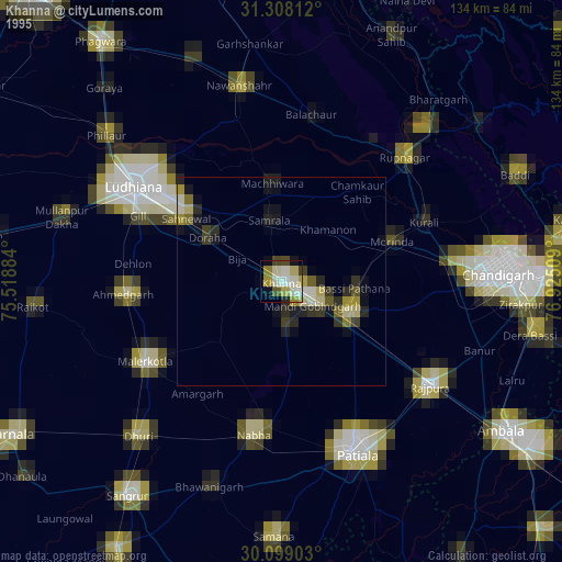
» NASA, Earths city lights 1995
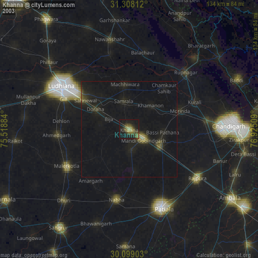
» NASA city lights 2003
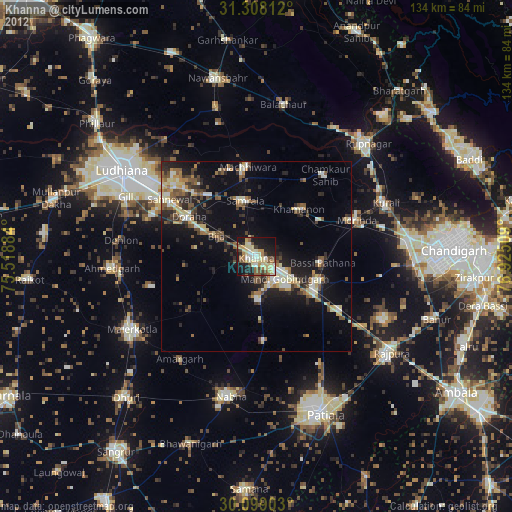
» Earth at Night: Flat Maps 2012, 2016