Kushālgarh night lights from space
Night Light of Kushālgarh (Rajasthan) from space (India) Src. Average luminocity for 10x10km area is 5.2992% and for 50x50km: 1.7939%.
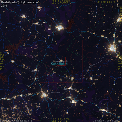
Analysis of Kushālgarh night lights 2016
Square area 10x10 km:
 0%
0%90-99
0.76%80-89
0%70-79
0.76%60-69
1.14%50-59
1.14%40-49
0.76%30-39
1.89%20-29
2.46%10-19
1.52%0-9
89.58%Square area 50x50 km:
0%90-99
0.12%80-89
0.04%70-79
0.07%60-69
0.27%50-59
0.38%40-49
0.4%30-39
0.86%20-29
1.08%10-19
0.89%0-9
95.9%Clear (daylight) street map image can be seen on geolist.org.
Map coordinates:
23° 50' 37.3" North, 73° 44' 51.4" East
23° 11' 56.4" North, 74° 27' 2.7" East
22° 33' 4.2" North, 75° 9' 13.9" East
Some cities around Kushālgarh sort by population:
• Bānswāra
38 km =23.6 mi,  358°
358°
• Dohad
45.2 km =28.1 mi,  205°
205°
• Jhābua
50.1 km =31.1 mi,  163°
163°
• Thandla
24.7 km =15.3 mi,  148°
148°
• Petlāwad
41.2 km =25.6 mi,  120°
120°
• Sailāna
56.4 km =35 mi,  58°
58°
• Partāpur
52.1 km =32.4 mi,  327°
327°
• Bamna
33.8 km =21 mi,  110°
110°
1265452 (p: 10,349)
Sources (retrieved 2019-11-25):
» Earth at Night: Flat Maps 2012, 2016