Kotra night lights from space
Night Light of Kotra (Uttar Pradesh) from space (India) Src. Average luminocity for 10x10km area is 2.1856% and for 50x50km: 6.1333%.
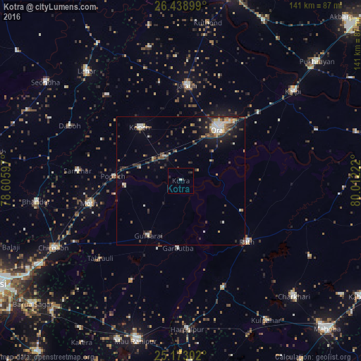
Analysis of Kotra night lights 2016
Square area 10x10 km:
 0.19%
0.19%90-99
0.57%80-89
0%70-79
0%60-69
0%50-59
0%40-49
0%30-39
1.89%20-29
1.52%10-19
0%0-9
95.83%Square area 50x50 km:
0.73%90-99
0.95%80-89
0.53%70-79
0.56%60-69
0.66%50-59
0.81%40-49
1.12%30-39
1.55%20-29
1.68%10-19
2.85%0-9
88.56%Clear (daylight) street map image can be seen on geolist.org.
Map coordinates:
26° 26' 20.4" North, 78° 36' 21.5" East
25° 48' 27.7" North, 79° 18' 32.7" East
25° 10' 22.9" North, 80° 0' 44" East
Some cities around Kotra sort by population:
• Orai
24.9 km =15.5 mi,  35°
35°
• Rāth
35 km =21.7 mi,  132°
132°
• Konch
26.1 km =16.2 mi,  322°
322°
• Gursarāi
24.8 km =15.4 mi,  211°
211°
• Moth
37.1 km =23.1 mi,  255°
255°
• Garautha
26.2 km =16.3 mi,  182°
182°
• Sarīla
36.8 km =22.9 mi,  95°
95°
• Gohānd
26.6 km =16.5 mi,  117°
117°
1265954 (p: 8,534)
Sources (retrieved 2019-11-25):
» Earth at Night: Flat Maps 2012, 2016