Garautha night lights from space
Night Light of Garautha (Uttar Pradesh) from space (India) Src. Average luminocity for 10x10km area is 3.2424% and for 50x50km: 1.7356%.
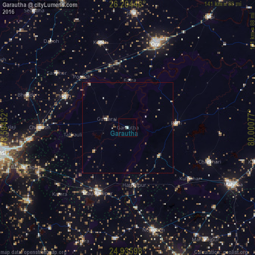
Analysis of Garautha night lights 2016
Square area 10x10 km:
 0.57%
0.57%90-99
1.7%80-89
0%70-79
0%60-69
0%50-59
0%40-49
0%30-39
0.76%20-29
0%10-19
0.76%0-9
96.21%Square area 50x50 km:
0.16%90-99
0.29%80-89
0.09%70-79
0.16%60-69
0.13%50-59
0.24%40-49
0.47%30-39
0.53%20-29
0.43%10-19
0.18%0-9
97.31%Clear (daylight) street map image can be seen on geolist.org.
Map coordinates:
26° 12' 16.1" North, 78° 35' 40.3" East
25° 34' 18.8" North, 79° 17' 51.5" East
24° 56' 9.5" North, 80° 0' 2.8" East
Some cities around Garautha sort by population:
• Rāth
27.1 km =16.8 mi,  84°
84°
• Gursarāi
12.8 km =8 mi,  293°
293°
• Rānīpur
42.9 km =26.7 mi,  213°
213°
• Harpālpur
31.8 km =19.8 mi,  173°
173°
• Moth
38.8 km =24.1 mi,  296°
296°
• Tori-Fatehpur
22.5 km =14 mi,  234°
234°
• Kotra
26.2 km =16.3 mi,  2°
2°
• Gohānd
28.6 km =17.8 mi,  60°
60°
1271582 (p: 9,489)
Sources (retrieved 2019-11-25):
» Earth at Night: Flat Maps 2012, 2016