Moth night lights from space
Night Light of Moth (Uttar Pradesh) from space (India) Src. Average luminocity for 10x10km area is 22.3106% and for 50x50km: 6.5795%.
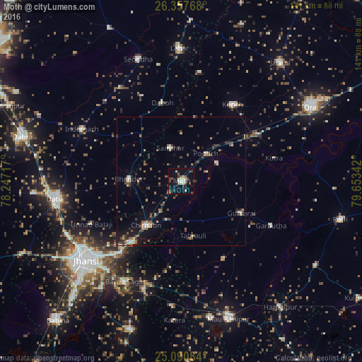
Analysis of Moth night lights 2016
Square area 10x10 km:
 2.46%
2.46%90-99
3.6%80-89
1.52%70-79
1.33%60-69
2.65%50-59
4.92%40-49
5.49%30-39
3.41%20-29
1.7%10-19
17.99%0-9
54.92%Square area 50x50 km:
0.4%90-99
0.88%80-89
0.39%70-79
0.5%60-69
0.92%50-59
1.31%40-49
1.5%30-39
1.46%20-29
1.16%10-19
3.63%0-9
87.85%Clear (daylight) street map image can be seen on geolist.org.
Map coordinates:
26° 21' 27.6" North, 78° 14' 49.8" East
25° 43' 33.4" North, 78° 57' 1" East
25° 5' 27" North, 79° 39' 12.3" East
Some cities around Moth sort by population:
• Konch
36 km =22.4 mi,  33°
33°
• Gursarāi
26.1 km =16.2 mi,  117°
117°
• Bhānder
20.5 km =12.7 mi,  273°
273°
• Samthar
13.8 km =8.6 mi,  341°
341°
• Daboh
31.6 km =19.6 mi,  346°
346°
• Chirgaon
21.9 km =13.6 mi,  218°
218°
• Tori-Fatehpur
34.3 km =21.3 mi,  151°
151°
• Pārīchha
30.9 km =19.2 mi, 218°
1262715 (p: 14,077)
Sources (retrieved 2019-11-25):
» Earth at Night: Flat Maps 2012, 2016