Gohānd night lights from space
Night Light of Gohānd (Uttar Pradesh) from space (India) Src. Average luminocity for 10x10km area is 1.7936% and for 50x50km: 1.2581%.
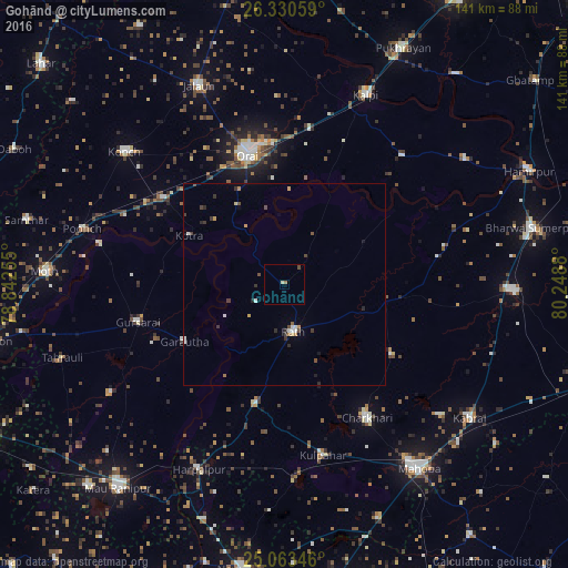
Analysis of Gohānd night lights 2016
Square area 10x10 km:
 0%
0%90-99
0.76%80-89
0%70-79
0%60-69
0.76%50-59
0%40-49
0.76%30-39
0%20-29
0%10-19
0%0-9
97.73%Square area 50x50 km:
0.08%90-99
0.25%80-89
0.07%70-79
0.17%60-69
0.13%50-59
0.08%40-49
0.29%30-39
0.35%20-29
0.27%10-19
0.13%0-9
98.17%Clear (daylight) street map image can be seen on geolist.org.
Map coordinates:
26° 19' 50.1" North, 78° 50' 33.2" East
25° 41' 55.4" North, 79° 32' 44.4" East
25° 3' 48.5" North, 80° 14' 55.7" East
Some cities around Gohānd sort by population:
• Orai
33.7 km =20.9 mi,  344°
344°
• Rāth
11.7 km =7.3 mi,  169°
169°
• Gursarāi
37.7 km =23.4 mi,  256°
256°
• Charkhāri
38.7 km =24 mi,  148°
148°
• Kharela
31.9 km =19.8 mi,  122°
122°
• Garautha
28.6 km =17.8 mi,  240°
240°
• Kotra
26.6 km =16.5 mi,  297°
297°
• Sarīla
15.6 km =9.7 mi,  56°
56°
1271078 (p: 7,286)
Sources (retrieved 2019-11-25):
» Earth at Night: Flat Maps 2012, 2016