Khed night lights from space
Night Light of Khed (Maharashtra) from space (India) Src. Average luminocity for 10x10km area is 6.1905% and for 50x50km: 2.0973%.
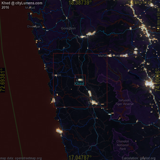
Analysis of Khed night lights 2016
Square area 10x10 km:
 0%
0%90-99
1.3%80-89
0.65%70-79
1.52%60-69
0.43%50-59
2.38%40-49
0.65%30-39
0.87%20-29
0%10-19
0.65%0-9
91.56%Square area 50x50 km:
0.04%90-99
0.49%80-89
0.23%70-79
0.38%60-69
0.24%50-59
0.3%40-49
0.17%30-39
0.38%20-29
0.27%10-19
0.53%0-9
96.97%Clear (daylight) street map image can be seen on geolist.org.
Map coordinates:
18° 23' 14.6" North, 72° 41' 37.7" East
17° 43' 8" North, 73° 23' 48.9" East
17° 2' 52.3" North, 74° 6' 0.2" East
Some cities around Khed sort by population:
• Chiplūn
23.8 km =14.8 mi,  149°
149°
• Mahād
40.6 km =25.2 mi,  2°
2°
• Pānchgani
48.5 km =30.1 mi,  61°
61°
• Mahābaleshwar
17.7 km =11 mi,  178°
178°
• Dābhol
27.1 km =16.8 mi,  237°
237°
• Harnai
33.5 km =20.8 mi,  288°
288°
• Goregaon
49.7 km =30.9 mi,  347°
347°
• Jalgaon
22 km =13.7 mi,  276°
276°
1266814 (p: 14,829)
Sources (retrieved 2019-11-25):
» Earth at Night: Flat Maps 2012, 2016