Dābhol night lights from space
Night Light of Dābhol (Maharashtra) from space (India) Src. Average luminocity for 10x10km area is 9.936% and for 50x50km: 0.9466%.
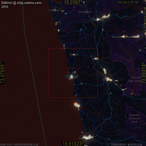
Analysis of Dābhol night lights 2016
Square area 10x10 km:
 0.83%
0.83%90-99
1.86%80-89
1.86%70-79
1.65%60-69
1.65%50-59
0.83%40-49
0.21%30-39
1.86%20-29
0.41%10-19
1.24%0-9
87.6%Square area 50x50 km:
0.04%90-99
0.16%80-89
0.1%70-79
0.16%60-69
0.14%50-59
0.11%40-49
0.23%30-39
0.23%20-29
0.06%10-19
0.14%0-9
98.63%Clear (daylight) street map image can be seen on geolist.org.
Map coordinates:
18° 15' 31.3" North, 72° 28' 36.8" East
17° 35' 23" North, 73° 10' 48" East
16° 55' 5.6" North, 73° 52' 59.3" East
Some cities around Dābhol sort by population:
• Chiplūn
35.5 km =22.1 mi,  100°
100°
• Mahād
60.3 km =37.5 mi,  24°
24°
• Srīvardhan
53.6 km =33.3 mi,  341°
341°
• Khed
27.1 km =16.8 mi,  57°
57°
• Mahābaleshwar
23.6 km =14.7 mi, 98°
• Mākhjan
49.2 km =30.6 mi,  136°
136°
• Harnai
26.4 km =16.4 mi, 340°
• Jalgaon
16.8 km =10.4 mi,  3°
3°
1273765 (p: 9,142)
Sources (retrieved 2019-11-25):
» Earth at Night: Flat Maps 2012, 2016