Goregaon night lights from space
Night Light of Goregaon (Maharashtra) from space (India) Src. Average luminocity for 10x10km area is 0.1688% and for 50x50km: 1.401%.
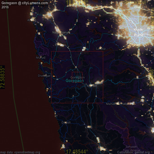
Analysis of Goregaon night lights 2016
Square area 10x10 km:
 0%
0%90-99
0%80-89
0%70-79
0%60-69
0%50-59
0%40-49
0%30-39
0%20-29
0%10-19
0.87%0-9
99.13%Square area 50x50 km:
0.02%90-99
0.33%80-89
0.06%70-79
0.18%60-69
0.31%50-59
0.12%40-49
0.13%30-39
0.26%20-29
0.28%10-19
0.69%0-9
97.61%Clear (daylight) street map image can be seen on geolist.org.
Map coordinates:
18° 49' 18" North, 72° 35' 18.1" East
18° 9' 17.4" North, 73° 17' 29.3" East
17° 29' 7.6" North, 73° 59' 40.6" East
Some cities around Goregaon sort by population:
• Roha
36.2 km =22.5 mi,  329°
329°
• Indāpur
16.7 km =10.4 mi,  344°
344°
• Mahād
15.4 km =9.6 mi,  121°
121°
• Srīvardhan
31.6 km =19.6 mi,  247°
247°
• Murud
39.8 km =24.7 mi,  298°
298°
• Nāgothana
46.1 km =28.6 mi, 339°
• Mhasla
19.2 km =11.9 mi,  262°
262°
• Harnai
43.2 km =26.8 mi,  208°
208°
1270914 (p: 6,946)
Sources (retrieved 2019-11-25):
» Earth at Night: Flat Maps 2012, 2016