Lodhīkheda night lights from space
Night Light of Lodhīkheda (Madhya Pradesh) from space (India) Src. Average luminocity for 10x10km area is 12.2443% and for 50x50km: 4.4883%.
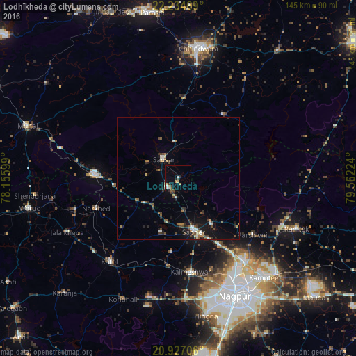
Analysis of Lodhīkheda night lights 2016
Square area 10x10 km:
 1.7%
1.7%90-99
1.52%80-89
2.08%70-79
1.89%60-69
0%50-59
1.89%40-49
2.27%30-39
1.52%20-29
0.95%10-19
3.03%0-9
83.14%Square area 50x50 km:
0.39%90-99
0.57%80-89
0.34%70-79
0.35%60-69
0.54%50-59
0.8%40-49
0.85%30-39
0.81%20-29
1.03%10-19
2.86%0-9
91.45%Clear (daylight) street map image can be seen on geolist.org.
Map coordinates:
22° 14' 4.9" North, 78° 9' 21.6" East
21° 34' 56.5" North, 78° 51' 32.8" East
20° 55' 37.4" North, 79° 33' 44.1" East
Some cities around Lodhīkheda sort by population:
• Pāndhurnā
34.4 km =21.4 mi,  272°
272°
• Saoner
22.9 km =14.2 mi,  163°
163°
• Sausar
10.4 km =6.5 mi,  321°
321°
• Kalmeshwar
39.4 km =24.5 mi,  170°
170°
• Khāpa
21.8 km =13.5 mi,  144°
144°
• Mohgaon
14.2 km =8.8 mi,  296°
296°
• Mowād
44.2 km =27.5 mi,  252°
252°
• Mohpa
30.4 km =18.9 mi,  185°
185°
1264860 (p: 9,994)
Sources (retrieved 2019-11-25):
» Earth at Night: Flat Maps 2012, 2016